
MyTopo
Center Point Iowa US Topo Map
Couldn't load pickup availability
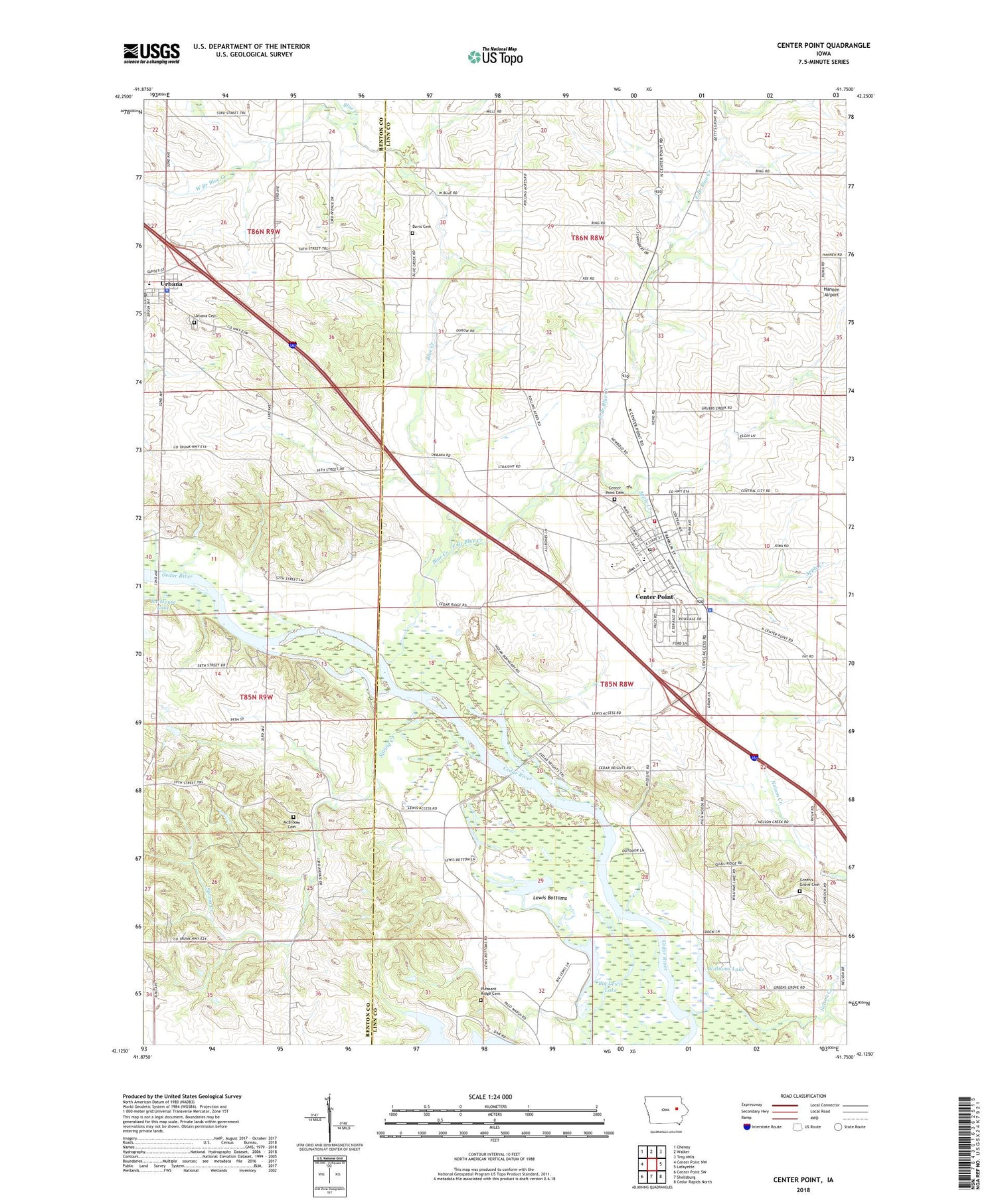
2022 topographic map quadrangle Center Point in the state of Iowa. Scale: 1:24000. Based on the newly updated USGS 7.5' US Topo map series, this map is in the following counties: Linn, Benton. The map contains contour data, water features, and other items you are used to seeing on USGS maps, but also has updated roads and other features. This is the next generation of topographic maps. Printed on high-quality waterproof paper with UV fade-resistant inks.
Quads adjacent to this one:
West: Center Point NW
Northwest: Cheney
North: Walker
Northeast: Troy Mills
East: Lafayette
Southeast: Cedar Rapids North
South: Shellsburg
Southwest: Center Point SW
This map covers the same area as the classic USGS quad with code o42091b7.
Contains the following named places: Apple Creek, Big Lewis Lake, Blue Creek, Center Point, Center Point - Urbana High School, Center Point - Urbana Intermediate School, Center Point - Urbana Middle School, Center Point - Urbana Preschool / Primary School, Center Point Cemetery, Center Point City Hall, Center Point Fire Department, Center Point Police Department, Center Point Post Office, Center Point Public Library, Center Point Regional Ambulance Service, Center Point United Methodist Church, City of Center Point, Davis Cemetery, East Branch Blue Creek, First Christian Church, Goose Pond, Greens Grove Cemetery, Hannen Airport, John Osborn Historical Marker, Lewis Bottoms, Lewis Bottoms Access County Park, Lewis Preserve County Park, Little Lewis Lake, Manatheka, McBroom Cemetery, Nelson Creek, Pleasant Ridge Cemetery, Primitive Baptist Church, Rolling Acres Golf Course, Saint Johns Lutheran Church, Spring Creek, Sweeting Quarry, Township of Washington, United Methodist Church, Urbana, Urbana Catholic Church, Urbana Cemetery, Urbana Post Office, Urbana Town Hall, West Branch Blue Creek, Williams Lake, ZIP Code: 52213


