MyTopo
Charter Oak Iowa US Topo Map
Couldn't load pickup availability
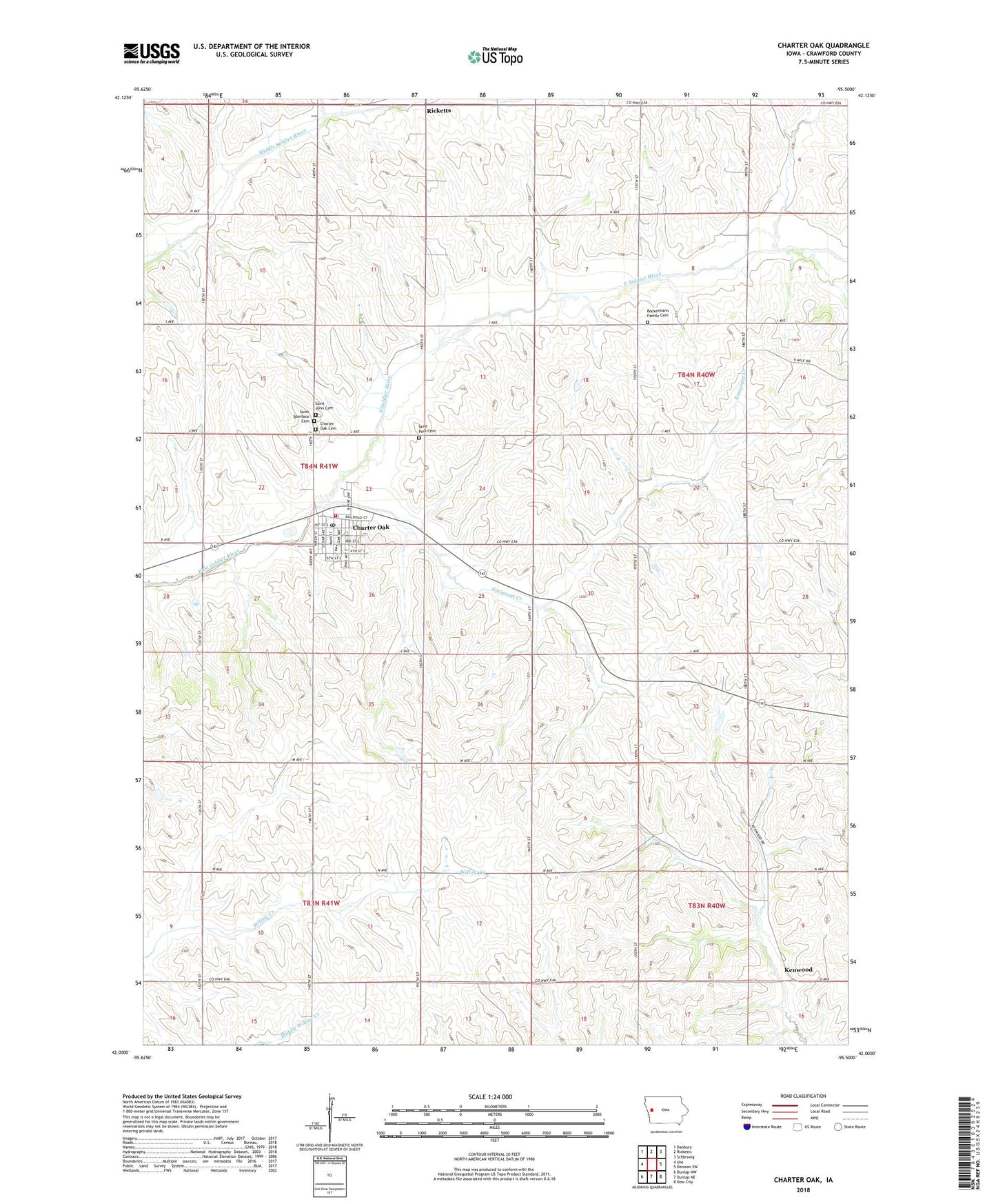
2022 topographic map quadrangle Charter Oak in the state of Iowa. Scale: 1:24000. Based on the newly updated USGS 7.5' US Topo map series, this map is in the following counties: Crawford. The map contains contour data, water features, and other items you are used to seeing on USGS maps, but also has updated roads and other features. This is the next generation of topographic maps. Printed on high-quality waterproof paper with UV fade-resistant inks.
Quads adjacent to this one:
West: Ute
Northwest: Danbury
North: Ricketts
Northeast: Schleswig
East: Denison SW
Southeast: Dow City
South: Dunlap NE
Southwest: Dunlap NW
This map covers the same area as the classic USGS quad with code o42095a5.
Contains the following named places: Bockelmann Family Cemetery, Charter Oak, Charter Oak - Ute Community School, Charter Oak - Ute Junior High School, Charter Oak Cemetery, Charter Oak Fire Department, Charter Oak Mercy Medical Center, Charter Oak Post Office, Charter Oak Public Library, City of Charter Oak, Como Post Office, Emigrant Creek, Hanover Wildlife Area, Kenwood, Kenwood Post Office, Saint Boniface Cemetery, Saint John Cemetery, Saint Johns Lutheran Church, Saint Paul Church, Saint Pauls Cemetery, Sioux Valley Memorial Hospital Heliport, Township of Charter Oak, United Methodist Church, ZIP Code: 51439