MyTopo
Danbury Iowa US Topo Map
Couldn't load pickup availability
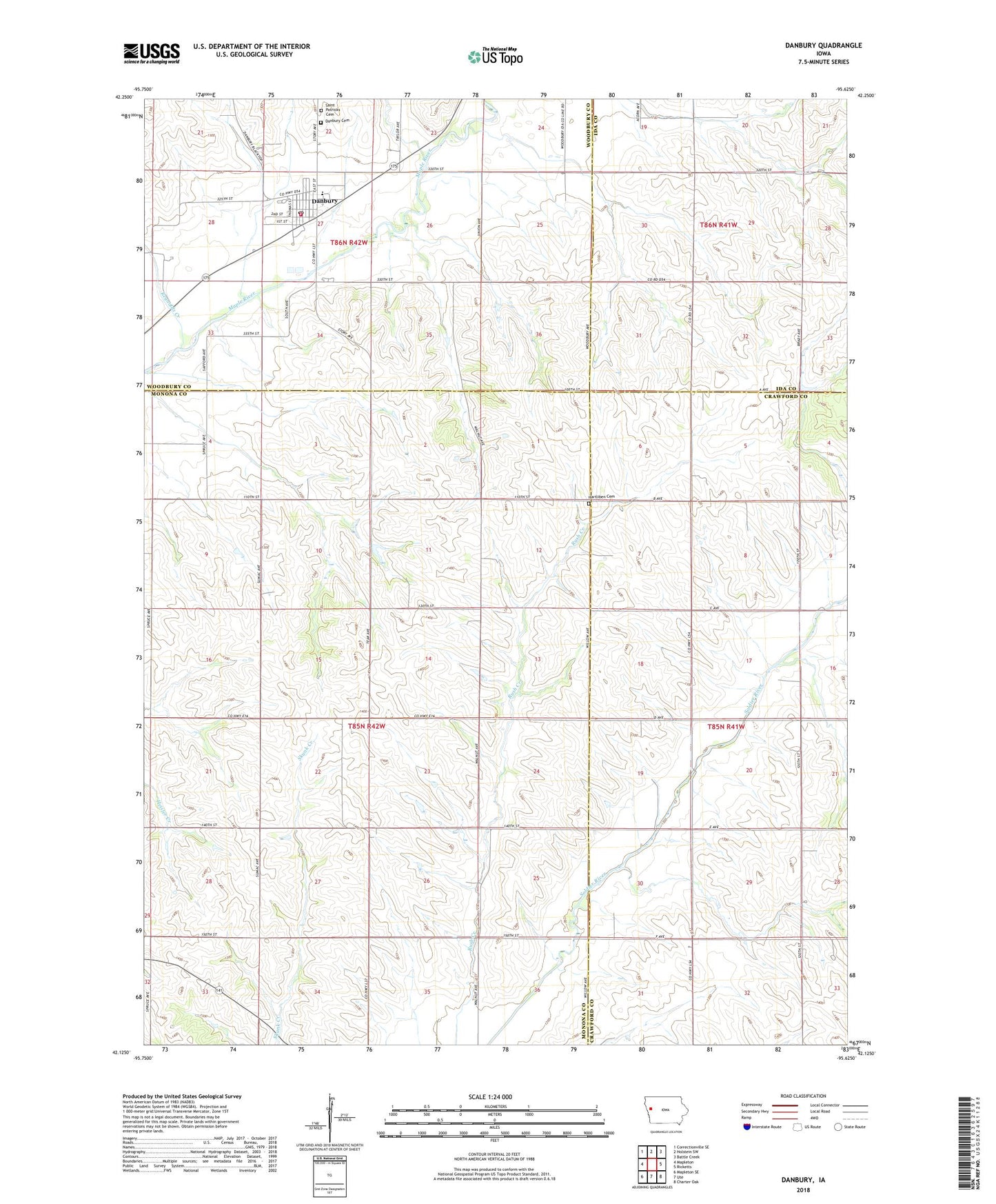
2022 topographic map quadrangle Danbury in the state of Iowa. Scale: 1:24000. Based on the newly updated USGS 7.5' US Topo map series, this map is in the following counties: Monona, Crawford, Woodbury, Ida. The map contains contour data, water features, and other items you are used to seeing on USGS maps, but also has updated roads and other features. This is the next generation of topographic maps. Printed on high-quality waterproof paper with UV fade-resistant inks.
Quads adjacent to this one:
West: Mapleton
Northwest: Correctionville SE
North: Holstein SW
Northeast: Battle Creek
East: Ricketts
Southeast: Charter Oak
South: Ute
Southwest: Mapleton SE
This map covers the same area as the classic USGS quad with code o42095b6.
Contains the following named places: Adrian Post Office, City of Danbury, Danbury, Danbury Catholic School, Danbury City Hall, Danbury Community Ambulance, Danbury Fire Department, Danbury Library, Danbury Methodist Church, Danbury Post Office, Hartliben Cemetery, Koker Creek, Liston Township Cemetery, Maple Valley Elementary School, Reynolds Creek, Saint Mary's Catholic Church, Saint Marys Cemetery, Saint Patricks Cemetery, Township of Cooper