MyTopo
Clarence Iowa US Topo Map
Couldn't load pickup availability
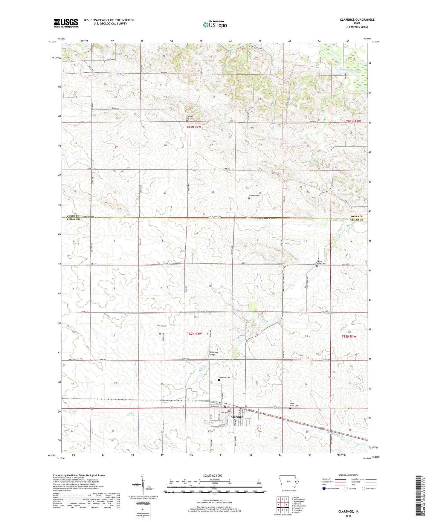
2022 topographic map quadrangle Clarence in the state of Iowa. Scale: 1:24000. Based on the newly updated USGS 7.5' US Topo map series, this map is in the following counties: Cedar, Jones. The map contains contour data, water features, and other items you are used to seeing on USGS maps, but also has updated roads and other features. This is the next generation of topographic maps. Printed on high-quality waterproof paper with UV fade-resistant inks.
Quads adjacent to this one:
West: Stanwood
Northwest: Morley
North: Wyoming West
Northeast: Wyoming East
East: Oxford Junction
Southeast: Lowden
South: Tipton East
Southwest: Tipton West
This map covers the same area as the classic USGS quad with code o41091h1.
Contains the following named places: Cedar, Cedar Post Office, City of Clarence, Clarence, Clarence Cemetery, Clarence City Hall, Clarence Community Ambulance, Clarence Community Park, Clarence Family Practice Center, Clarence Fire Department, Clarence Nursing Home, Clarence Police Department, Clarence Post Office, Clarence Water Treatment Plant, Dayton Valley Cemetery, Diamond Cemetery, Jungletown Public Access, Mill Creek Bridge, North Cedar Junior and Senior High School, Onion Grove Cemetery, Pleasant Hill Cemetery, Saint Johns Cemetery, Saint Johns United Church of Christ, Saint Lukes Physicians Clinic, Township of Dayton, Township of Hale, United Methodist Church, Zybell Memorial Library, ZIP Code: 52216