MyTopo
Oxford Junction Iowa US Topo Map
Couldn't load pickup availability
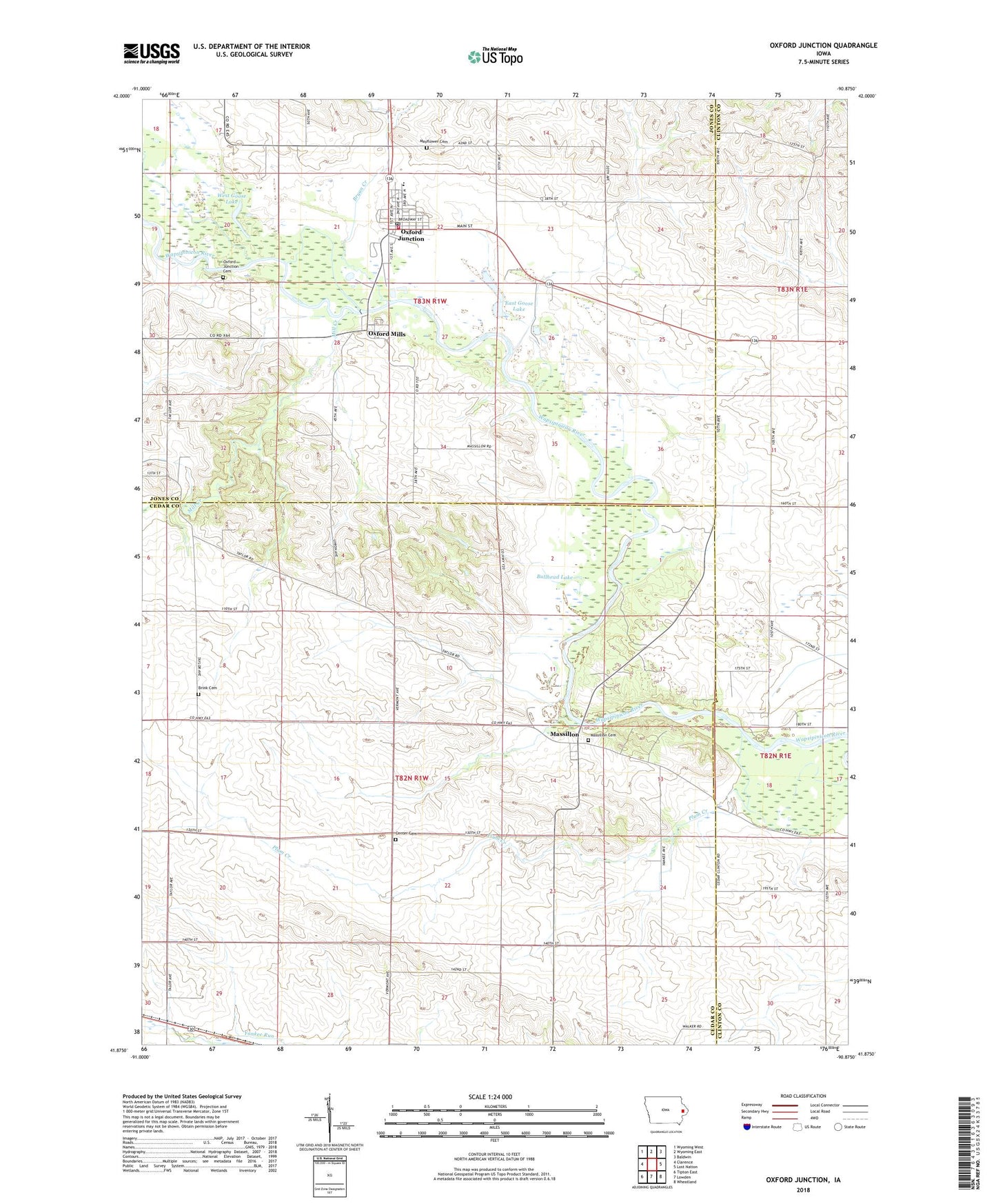
2022 topographic map quadrangle Oxford Junction in the state of Iowa. Scale: 1:24000. Based on the newly updated USGS 7.5' US Topo map series, this map is in the following counties: Cedar, Jones, Clinton. The map contains contour data, water features, and other items you are used to seeing on USGS maps, but also has updated roads and other features. This is the next generation of topographic maps. Printed on high-quality waterproof paper with UV fade-resistant inks.
Quads adjacent to this one:
West: Clarence
Northwest: Wyoming West
North: Wyoming East
Northeast: Baldwin
East: Lost Nation
Southeast: Wheatland
South: Lowden
Southwest: Tipton East
This map covers the same area as the classic USGS quad with code o41090h8.
Contains the following named places: Assembly of God Church, Benjamin Fraseur Log Cabin, Bennet Lake, Bennet Lake Dam, Brink Cemetery, Bryan Creek, Bullhead Lake, Center Cemetery, City of Oxford Junction, Diamond Community Church, East Goose Lake, Massillon, Massillon Area Park, Massillon Cemetery, Massillon Post Office, Mayflower Cemetery, Midland Elementary School, Midland Intermediate School, Mill Creek, Oxford Junction, Oxford Junction Cemetery, Oxford Junction City Hall, Oxford Junction Post Office, Oxford Junction Volunteer Fire Department, Oxford Mills, Oxford Mills Post Office, Plum Creek, Saint Marks Lutheran Church, Township of Massillon, Township of Oxford, United Methodist Church, Wapsie Park, West Goose Lake, Wregie Memorial Library, ZIP Code: 52323