MyTopo
Wyoming West Iowa US Topo Map
Couldn't load pickup availability
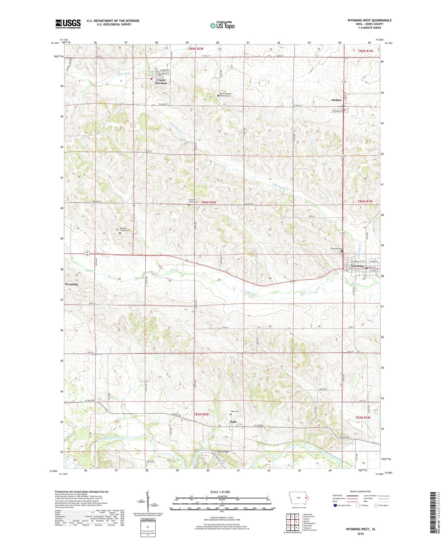
2022 topographic map quadrangle Wyoming West in the state of Iowa. Scale: 1:24000. Based on the newly updated USGS 7.5' US Topo map series, this map is in the following counties: Jones. The map contains contour data, water features, and other items you are used to seeing on USGS maps, but also has updated roads and other features. This is the next generation of topographic maps. Printed on high-quality waterproof paper with UV fade-resistant inks.
Quads adjacent to this one:
West: Morley
Northwest: Monticello
North: Scotch Grove
Northeast: Canton
East: Wyoming East
Southeast: Oxford Junction
South: Clarence
Southwest: Stanwood
This map covers the same area as the classic USGS quad with code o42091a1.
Contains the following named places: Calvary Baptist Church, Center Junction, Center Junction Census Designated Place, Center Junction Community Building, Center Junction Fire Department, Center Junction Post Office, Chamberlain Park, City of Center Junction, City of Onslow, City of Wyoming, Hale, Hale Bridge, Hale Cemetery, Hale Post Office, Little Bear Country Club, Little Bear Creek, Lutheran Church, Madison, Madison Center Cemetery, Madison Post Office, Madison Village Cemetery, Maquoketa Medical Associates Center, Methodist Church, Midland Community Ambulance, Midland Middle / High School, North Madison Pioneers Cemetery, Onslow, Onslow Ball Park, Onslow Elementary School, Onslow Fire Department and First Responders, Onslow Post Office, Presbyterian Church, Township of Madison, Wyoming, Wyoming Cemetery, Wyoming City Hall, Wyoming Historical Museum, Wyoming Library, Wyoming Post Office, ZIP Code: 52212