MyTopo
Clearfield Iowa US Topo Map
Couldn't load pickup availability
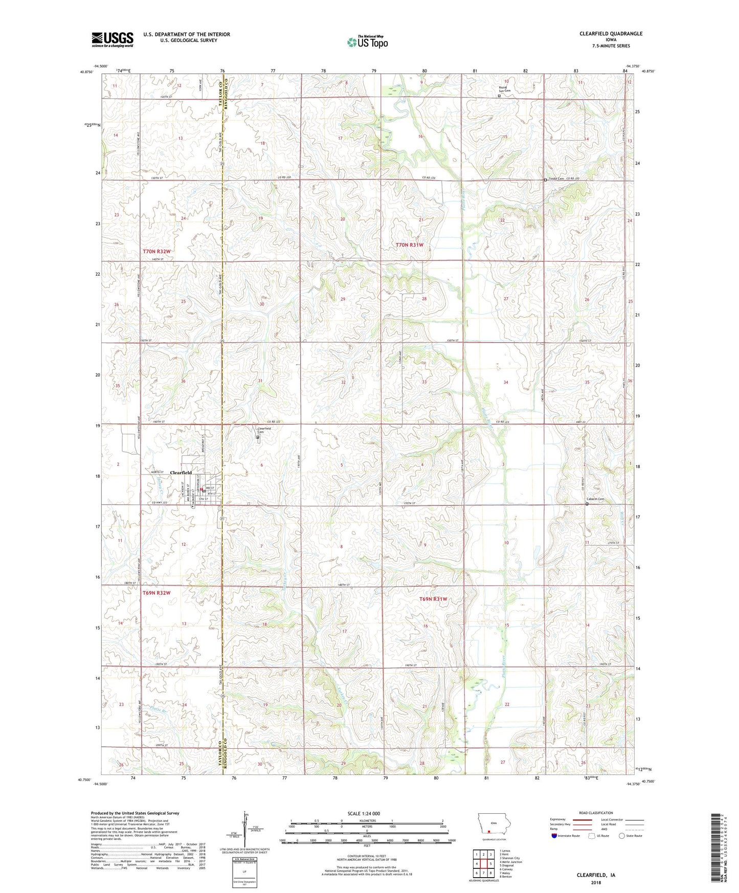
2022 topographic map quadrangle Clearfield in the state of Iowa. Scale: 1:24000. Based on the newly updated USGS 7.5' US Topo map series, this map is in the following counties: Ringgold, Taylor. The map contains contour data, water features, and other items you are used to seeing on USGS maps, but also has updated roads and other features. This is the next generation of topographic maps. Printed on high-quality waterproof paper with UV fade-resistant inks.
Quads adjacent to this one:
West: Merle Junction
Northwest: Lenox
North: Kent
Northeast: Shannon City
East: Diagonal
Southeast: Benton
South: Maloy
Southwest: Conway
This map covers the same area as the classic USGS quad with code o40094g4.
Contains the following named places: Area Bible Fellowship Church, Cabaret Cemetery, City of Clearfield, Clearfield, Clearfield Cemetery, Clearfield Christian Church, Clearfield City Hall, Clearfield Community School, Clearfield Fire Department, Clearfield Post Office, Clearfield Public Library, Clearview Home, Gard Branch, Lone Office Post Office, Marena, Marena Post Office, Methodist Church, Rising Sun Cemetery, Tindle Cemetery, Township of Grant, Township of Lincoln, ZIP Code: 50840