MyTopo
Diagonal Iowa US Topo Map
Couldn't load pickup availability
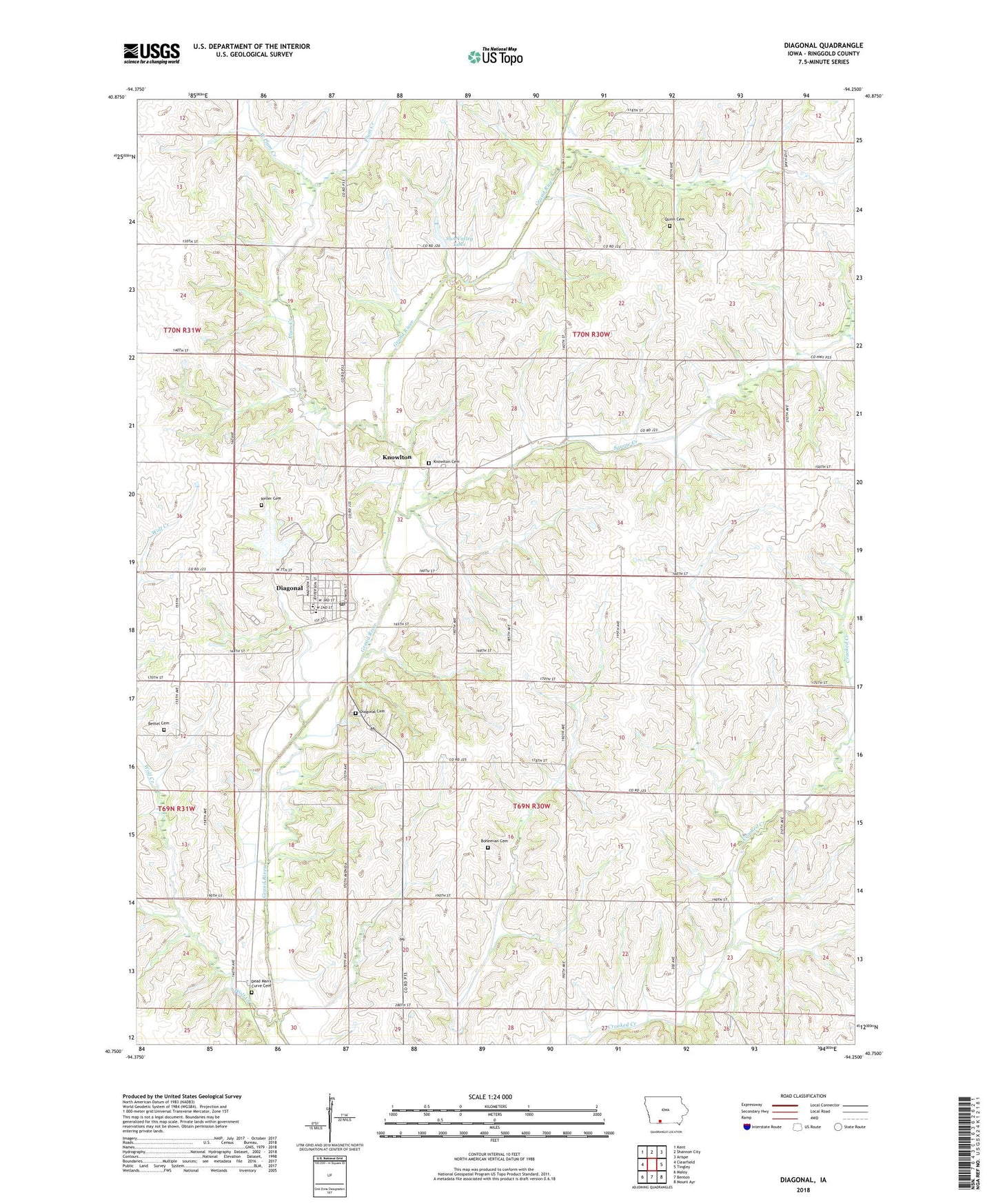
2023 topographic map quadrangle Diagonal in the state of Iowa. Scale: 1:24000. Based on the newly updated USGS 7.5' US Topo map series, this map is in the following counties: Ringgold. The map contains contour data, water features, and other items you are used to seeing on USGS maps, but also has updated roads and other features. This is the next generation of topographic maps. Printed on high-quality waterproof paper with UV fade-resistant inks.
Quads adjacent to this one:
West: Clearfield
Northwest: Kent
North: Shannon City
Northeast: Arispe
East: Tingley
Southeast: Mount Ayr
South: Benton
Southwest: Maloy
This map covers the same area as the classic USGS quad with code o40094g3.
Contains the following named places: Bethel Cemetery, Bohemian Cemetery, Centenary Cemetery, City of Diagonal, Dead Mans Cut Cemetery, Diagonal, Diagonal Cemetery, Diagonal City Hall, Diagonal Elementary School, Diagonal First Response Team, Diagonal Middle / High School, Diagonal Post Office, Diagonal Printing Museum, Diagonal United Church, Flushing Post Office, Goshen, Goshen Post Office, Indian Creek, Keller Cemetery, Kew, Kew Post Office, Knowlton, Knowlton Post Office, Kokesh County Recreation Area, Plum Creek, Quinn Cemetery, Squaw Creek, Sun Valley Lake, Sun Valley Lake Dam, Township of Jefferson, Township of Washington, West Plum Creek, Wolf Creek, ZIP Code: 50845