MyTopo
Creston West Iowa US Topo Map
Couldn't load pickup availability
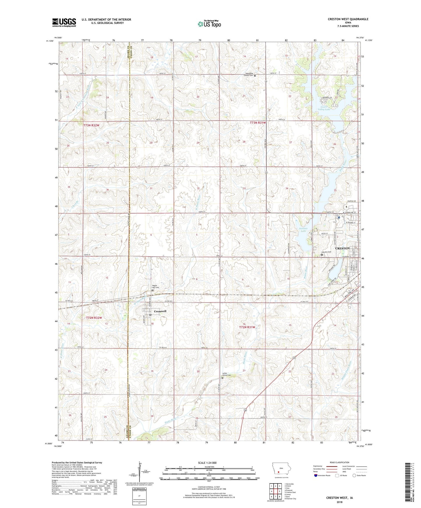
2022 topographic map quadrangle Creston West in the state of Iowa. Scale: 1:24000. Based on the newly updated USGS 7.5' US Topo map series, this map is in the following counties: Union, Adams. The map contains contour data, water features, and other items you are used to seeing on USGS maps, but also has updated roads and other features. This is the next generation of topographic maps. Printed on high-quality waterproof paper with UV fade-resistant inks.
Quads adjacent to this one:
West: Prescott
Northwest: Nevinville
North: Orient
Northeast: Zion
East: Creston East
Southeast: Shannon City
South: Kent
Southwest: Lenox
This map covers the same area as the classic USGS quad with code o41094a4.
Contains the following named places: Calvary Cemetery, City of Cromwell, Country Court Mobile Home Park, Cozy Camper Campgrounds, Crestmoor Country Club, Creston Nursing Rehabilitation Center, Cromwell, Cromwell Cemetery, Cromwell Congregational Church, Cromwell Heliport, Cromwell Post Office, Frank Phillips Visitors Information Center, Graceland College, Greater Community Hospital, Greater Community Hospital Heliport, Greater Regional Medical Center, Green Valley Lake, Green Valley Lake Dam, Green Valley State Park, Internal Medicine Consultants, Kingdom Hall of Jehovahs Witnesses, KITR-FM (Creston), KSIB-AM (Creston), Lake McKinley, Lytles Grove Cemetery, McKinley Park, Mercer Field, Mitchell Marsh, Pine Valley Golf Course, Platt Post Office, Southwest Foot and Ankle Center, Southwestern Community College - Creston Campus, Spaulding, Spaulding Center Cemetery, Summit Lake, Summit Lake Wildlife Management Area, Township of Douglas, Township of Spaulding, Union County Historical Village and Museum, Wallace Ultralight Airport, ZIP Codes: 50801, 50842