MyTopo
Prescott Iowa US Topo Map
Couldn't load pickup availability
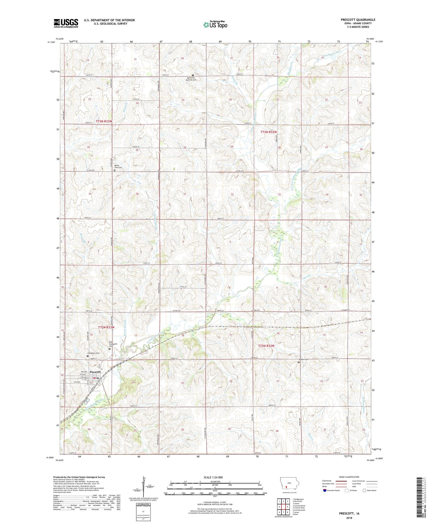
2022 topographic map quadrangle Prescott in the state of Iowa. Scale: 1:24000. Based on the newly updated USGS 7.5' US Topo map series, this map is in the following counties: Adams. The map contains contour data, water features, and other items you are used to seeing on USGS maps, but also has updated roads and other features. This is the next generation of topographic maps. Printed on high-quality waterproof paper with UV fade-resistant inks.
Quads adjacent to this one:
West: Corning North
Northwest: Bridgewater
North: Nevinville
Northeast: Orient
East: Creston West
Southeast: Kent
South: Lenox
Southwest: Corning South
This map covers the same area as the classic USGS quad with code o41094a5.
Contains the following named places: Bohemian National Cemetery, Cipra Branch, City of Prescott, East Fork East Nodaway River, Evergreen Cemetery, Kline Museum, Kosar Branch, Mount Zion Branch, Mount Zion Cemetery, Old Evergreen Cemetery, Prescott, Prescott City Hall, Prescott Community Park, Prescott Elementary School, Prescott Post Office, Prescott Public Library, Prescott United Church of Christ, Prescott Volunteer Fire Department, Shanghai Creek, Summit Cemetery, Township of Colony, Township of Union, Union Townhall, ZIP Code: 50859