MyTopo
Delmar South Iowa US Topo Map
Couldn't load pickup availability
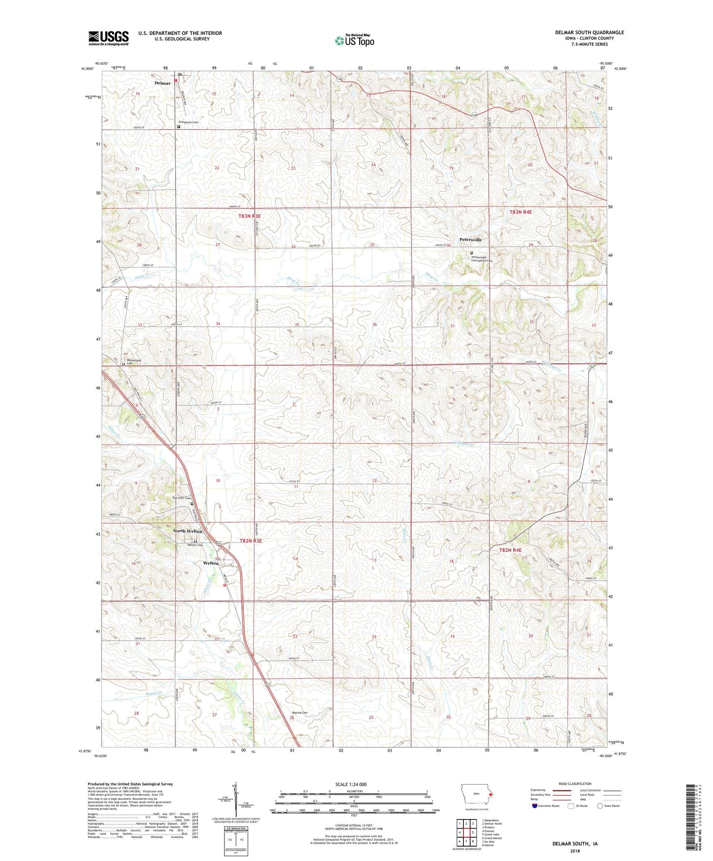
2022 topographic map quadrangle Delmar South in the state of Iowa. Scale: 1:24000. Based on the newly updated USGS 7.5' US Topo map series, this map is in the following counties: Clinton. The map contains contour data, water features, and other items you are used to seeing on USGS maps, but also has updated roads and other features. This is the next generation of topographic maps. Printed on high-quality waterproof paper with UV fade-resistant inks.
Quads adjacent to this one:
West: Elwood
Northwest: Maquoketa
North: Delmar North
Northeast: Preston
East: Goose Lake
Southeast: Malone
South: De Witt
Southwest: Grand Mound
This map covers the same area as the classic USGS quad with code o41090h5.
Contains the following named places: Berlin Creek, Bloomfield Cemetery, City of Delmar, City of Welton, Clinton County, Delmar Post Office, Delmar Volunteer Fire Department, Evergreen Cemetery, Immaculate Conception Cemetery, Immaculate Conception Church, North Welton, Oakview Cemetery, Petersville, Petersville Post Office, Saint Annes Catholic Church, Seventh Day Baptist Cemetery, Township of Bloomfield, Township of Welton, Walrod Cemetery, Welton, Welton Elementary School, Welton Fire and Rescue Department, Welton Post Office, ZIP Code: 52774