MyTopo
Goose Lake Iowa US Topo Map
Couldn't load pickup availability
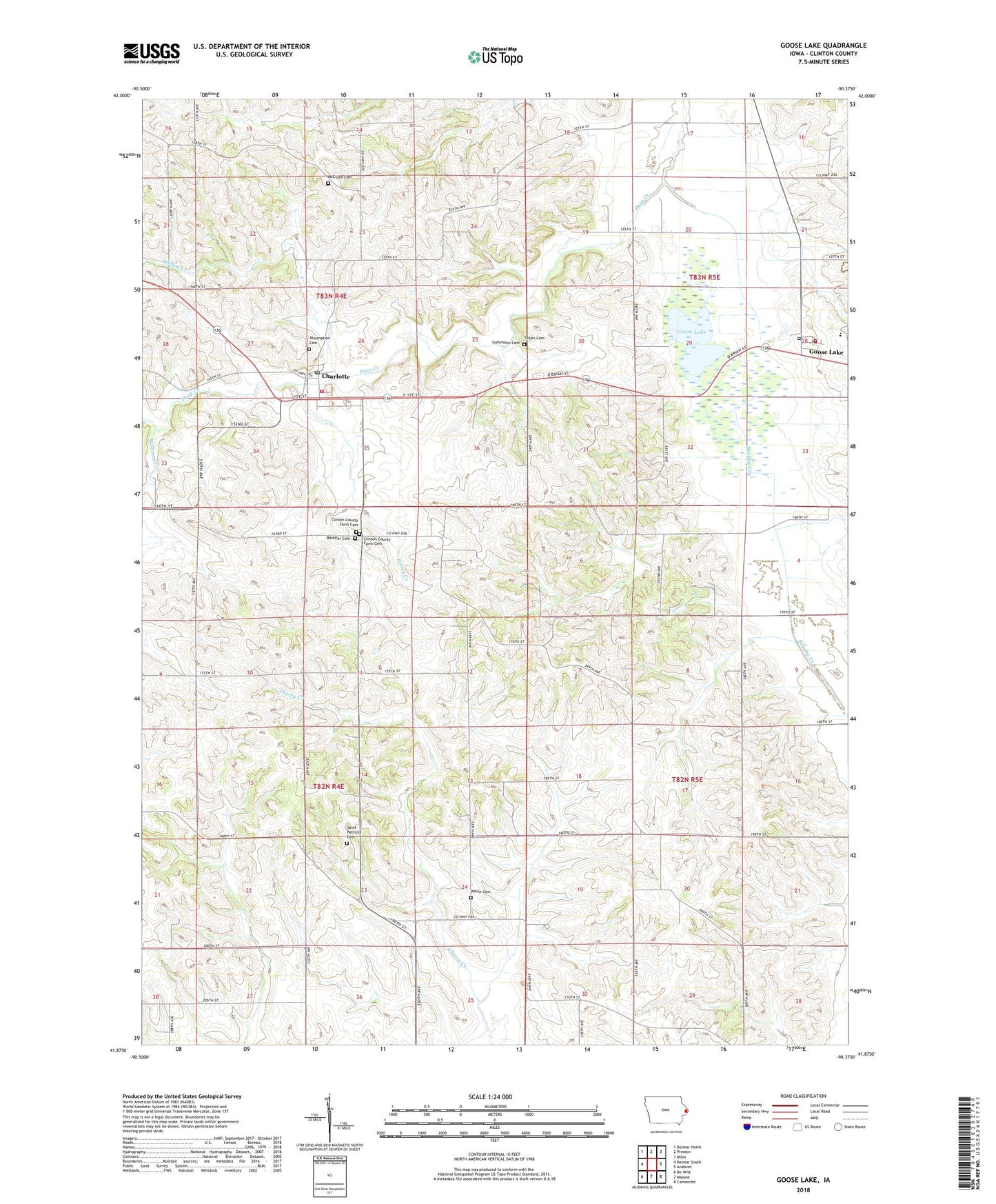
2022 topographic map quadrangle Goose Lake in the state of Iowa. Scale: 1:24000. Based on the newly updated USGS 7.5' US Topo map series, this map is in the following counties: Clinton. The map contains contour data, water features, and other items you are used to seeing on USGS maps, but also has updated roads and other features. This is the next generation of topographic maps. Printed on high-quality waterproof paper with UV fade-resistant inks.
Quads adjacent to this one:
West: Delmar South
Northwest: Delmar North
North: Preston
Northeast: Miles
East: Andover
Southeast: Camanche
South: Malone
Southwest: De Witt
This map covers the same area as the classic USGS quad with code o41090h4.
Contains the following named places: Ascension Lutheran Church, Assumption Catholic Church, Assumption Cemetery, Assumption Church School, Charlotte, Charlotte City Hall, Charlotte Fire Department, Charlotte First Responders, Charlotte Post Office, City of Charlotte, City of Goose Lake, Clinton County Farm Cemetery, Clinton County Home, Glahn Cemetery, Gohlmann Cemetery, Goose Lake, Goose Lake City Hall, Goose Lake Fire Department, Goose Lake Post Office, Goose Lake State Wildlife Area, Honey Creek, Immanuel Lutheran Church, McClure Cemetery, Northeast Alternative High School, Northeast Elementary School, Rossiter Cemetery, Saint Patricks Cemetery, Saint Patricks Church, Township of Washington, Township of Waterford, Villanova, Villanova Post Office, White Cemetery, Williams Creek, Willow Creek, ZIP Codes: 52731, 52750