MyTopo
Grand Mound Iowa US Topo Map
Couldn't load pickup availability
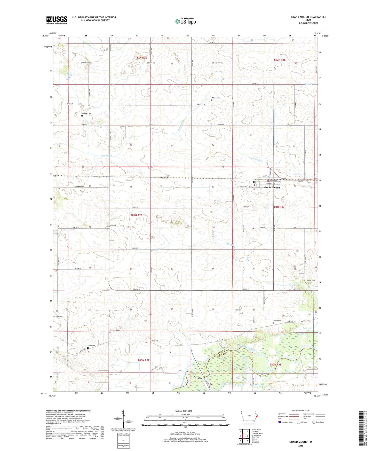
2022 topographic map quadrangle Grand Mound in the state of Iowa. Scale: 1:24000. Based on the newly updated USGS 7.5' US Topo map series, this map is in the following counties: Clinton, Scott. The map contains contour data, water features, and other items you are used to seeing on USGS maps, but also has updated roads and other features. This is the next generation of topographic maps. Printed on high-quality waterproof paper with UV fade-resistant inks.
Quads adjacent to this one:
West: Wheatland
Northwest: Lost Nation
North: Elwood
Northeast: Delmar South
East: De Witt
Southeast: Eldridge
South: Donahue
Southwest: Dixon
This map covers the same area as the classic USGS quad with code o41090g6.
Contains the following named places: Allison Cemetery, Allison School, Barber Cemetery, Cadda, Cadda Post Office, Calvary Cemetery, City of Grand Mound, Dutton Cemetery, Evergreen Cemetery, Gods Family Baptist Church, Grand Mound, Grand Mound City Hall, Grand Mound Elementary School, Grand Mound Medical Clinic, Grand Mound Post Office, Grand Mound Volunteer Fire Department, Griebel School, Ground Mound Ball Park, Immanuel Lutheran Cemetery, Immanuel Lutheran Church, Kvindherred Cemetery, Langbehn School, Meints School, Mowder Cemetery, Mud Creek, Orange Post Office, Our Saviors Church, Point Pleasant Post Office, Saint Pauls United Methodist Church, Saints Philip and James Catholic Church, Stemple School, Township of Olive, Township of Orange, Union Cemetery, ZIP Codes: 52729, 52751