MyTopo
Duncan Iowa US Topo Map
Couldn't load pickup availability
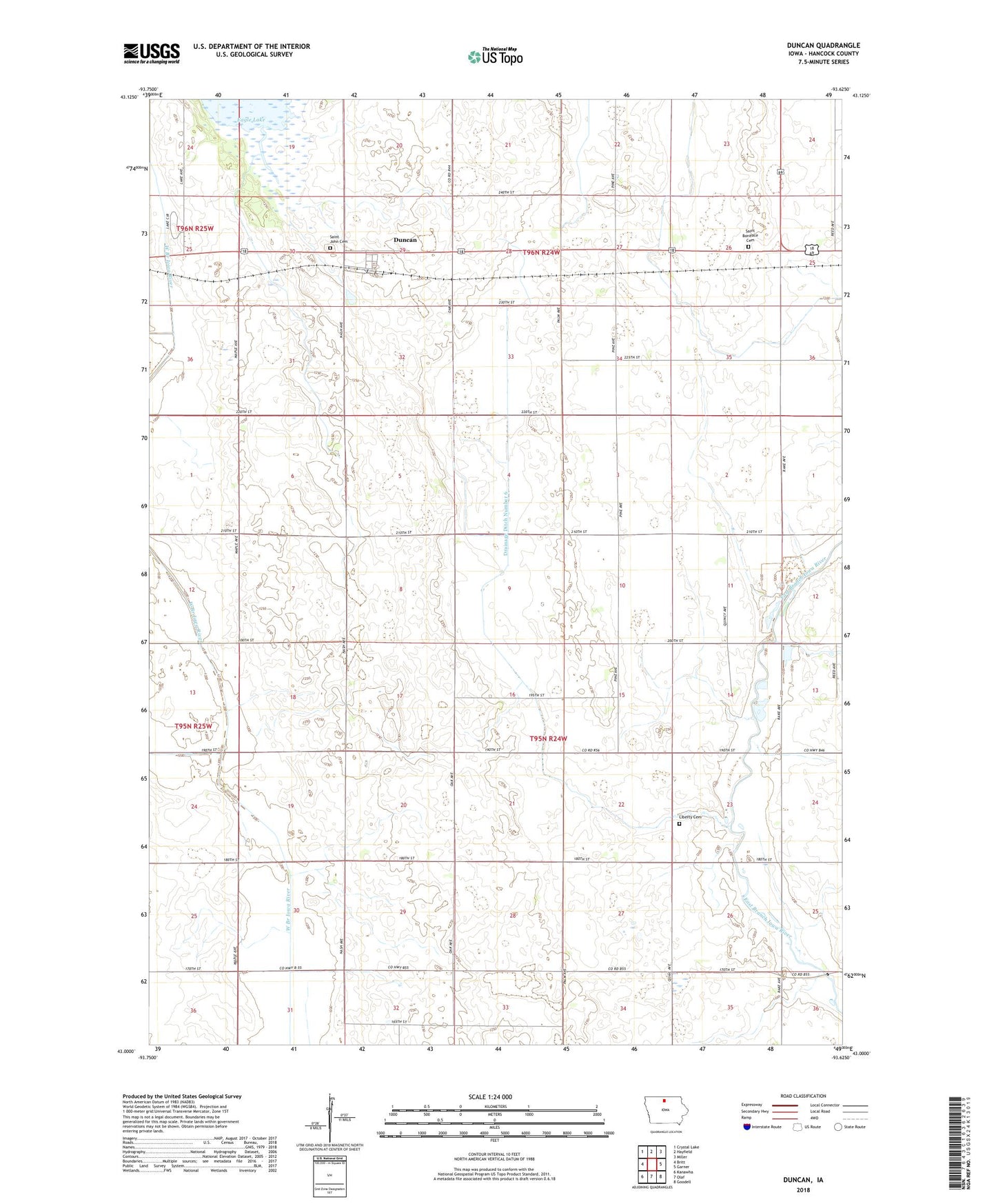
2022 topographic map quadrangle Duncan in the state of Iowa. Scale: 1:24000. Based on the newly updated USGS 7.5' US Topo map series, this map is in the following counties: Hancock. The map contains contour data, water features, and other items you are used to seeing on USGS maps, but also has updated roads and other features. This is the next generation of topographic maps. Printed on high-quality waterproof paper with UV fade-resistant inks.
Quads adjacent to this one:
West: Britt
Northwest: Crystal Lake
North: Hayfield
Northeast: Miller
East: Garner
Southeast: Goodell
South: Olaf
Southwest: Kanawha
This map covers the same area as the classic USGS quad with code o43093a6.
Contains the following named places: Drainage Ditch Number 6, Duncan, Duncan Census Designated Place, Duncan Community Hall, Duncan Post Office, Eagle Lake Woodland Area, Garner Quarry, German Post Office, Hancock County, Liberty Cemetery, Saint Boniface Cemetery, Saint John Cemetery, Township of Liberty