MyTopo
Garner Iowa US Topo Map
Couldn't load pickup availability
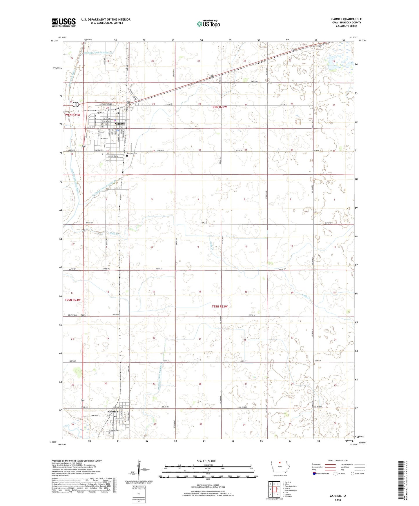
2022 topographic map quadrangle Garner in the state of Iowa. Scale: 1:24000. Based on the newly updated USGS 7.5' US Topo map series, this map is in the following counties: Hancock. The map contains contour data, water features, and other items you are used to seeing on USGS maps, but also has updated roads and other features. This is the next generation of topographic maps. Printed on high-quality waterproof paper with UV fade-resistant inks.
Quads adjacent to this one:
West: Duncan
Northwest: Hayfield
North: Miller
Northeast: Clear Lake West
East: Ventura Heights
Southeast: Thornton
South: Goodell
Southwest: Olaf
This map covers the same area as the classic USGS quad with code o43093a5.
Contains the following named places: Belmond Klemme Middle School, Calvary Cemetery, City of Garner, City of Klemme, Concord Care Center, Concord Cemetery, Concord Park, Concord Post Office, Drainage Ditch Number 81, Drainage Ditch Number 9, Family Eye Care Center, Farmers Cooperative Society Elevator, Galls Creek, Garner, Garner - Hayfield - Ventura High School, Garner - Hayfield Middle School, Garner Elementary School, Garner Family Practice, Garner Fire Department, Garner Golf and Country Club, Garner Medical Clinic, Garner Municipal Airport, Garner Police Department, Garner Post Office, Garner Public Library, Garner Volunteer Ambulance Service, Hancock County Courthouse, Hancock County Sheriff's Office, Immanuel Reform Church, Jehovahs Witnesses Kingdom Hall, KIOW-FM (Forest City), Klemme, Klemme Post Office, Klemme Public Library, New Horizons Alternative High School, Reformed Church in the United States, Saint Boniface Catholic Church, Saint Paul Lutheran Church, Schuldt Wildlife Area, Slippery Elm Golf Course, Township of Ell, United Methodist Church, United Presbyterian Church, Wood Chiropractic Clinic, Zion United Church of Christ, ZIP Codes: 50438, 50449