MyTopo
Epworth Iowa US Topo Map
Couldn't load pickup availability
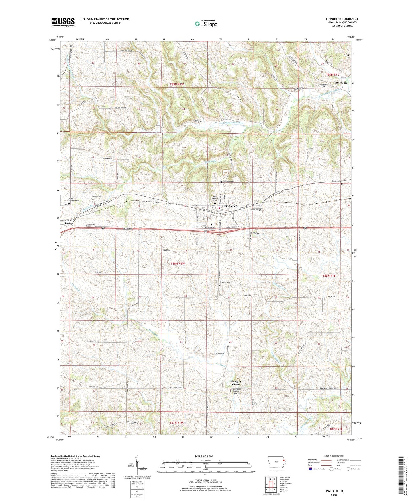
2022 topographic map quadrangle Epworth in the state of Iowa. Scale: 1:24000. Based on the newly updated USGS 7.5' US Topo map series, this map is in the following counties: Dubuque. The map contains contour data, water features, and other items you are used to seeing on USGS maps, but also has updated roads and other features. This is the next generation of topographic maps. Printed on high-quality waterproof paper with UV fade-resistant inks.
Quads adjacent to this one:
West: Dyersville East
Northwest: New Vienna
North: Holy Cross
Northeast: Sherrill
East: Peosta
Southeast: Bernard
South: Fillmore
Southwest: Cascade
This map covers the same area as the classic USGS quad with code o42090d8.
Contains the following named places: Camp Little Cloud, Centennial Park, Channingville Post Office, City of Epworth, Divine Word College, Dubuque County, Epworth, Epworth Cemetery, Epworth Elementary School, Epworth Emergency Service, Epworth Fire Department, Epworth Police Department, Epworth Post Office, Epworth United Methodist Chuch, Grace Lutheran Church, Highview Cemetery, Hogan Cemetery, Hogans Branch, Johnson Cemetery, Kidder, Lattner Post Office, Lattnerville, Lattnerville Catholic Cemetery, Matthew Jacoby Memorial Library, Placid Post Office, Pleasant Grove, Saint Johns Catholic Church, Saint Johns Cemetery, Saint Johns Rectory School, Saint Joseph Catholic Cemetery, Saint Patrick Catholic Church, Saint Patricks Cemetery, Seton Catholic School, Township of Taylor, Western Dubuque High School, ZIP Code: 52045