MyTopo
Peosta Iowa US Topo Map
Couldn't load pickup availability
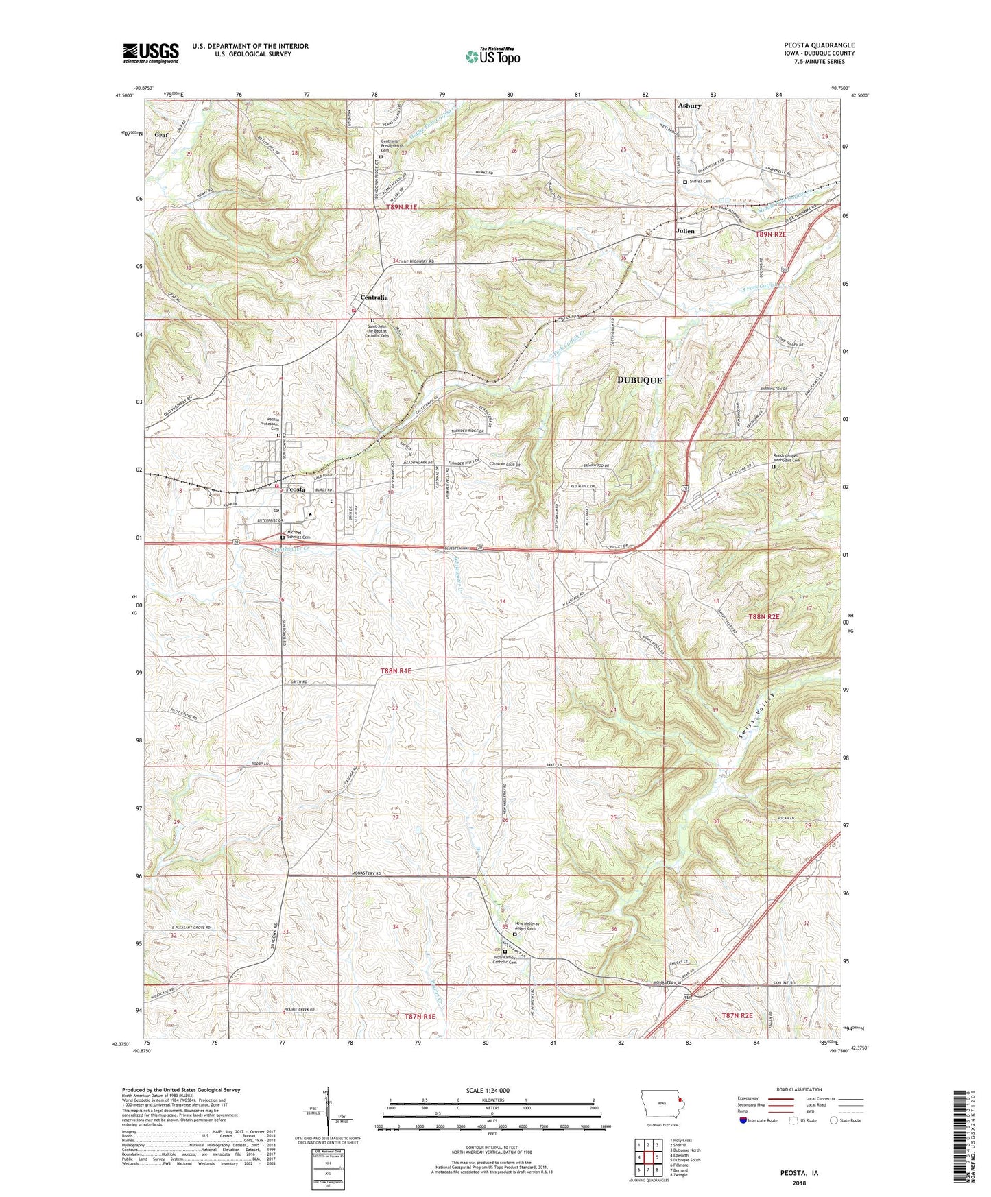
2022 topographic map quadrangle Peosta in the state of Iowa. Scale: 1:24000. Based on the newly updated USGS 7.5' US Topo map series, this map is in the following counties: Dubuque. The map contains contour data, water features, and other items you are used to seeing on USGS maps, but also has updated roads and other features. This is the next generation of topographic maps. Printed on high-quality waterproof paper with UV fade-resistant inks.
Quads adjacent to this one:
West: Epworth
Northwest: Holy Cross
North: Sherrill
Northeast: Dubuque North
East: Dubuque South
Southeast: Zwingle
South: Bernard
Southwest: Fillmore
This map covers the same area as the classic USGS quad with code o42090d7.
Contains the following named places: Burton Payne Library, Centralia, Centralia - Peosta Fire Department, Centralia Church, Centralia Peosta Emergency Volunteer Fire and EMS Station, Centralia Post Office, Centralia Presbyterian Cemetery, City of Centralia, City of Graf, City of Peosta, Derrinane Post Office, Dubuque County Fairgrounds, Dubuque County Home, Graf, Graf Post Office, Heritage Trail, Holy Family Cemetery, Holy Family Church, Ice Harbor Emporium, Julian, Julian Post Office, Julien, Julien Post Office, Lost Canyon Mobile Home Park, McCants Post Office, Michael Schmitt Cemetery, New Melleray Abbey, New Melleray Abbey Cemetery, Northeast Iowa Community College Peosta Campus, Paramount Emergency Medical Services West Campus, Peosta, Peosta Elementary School, Peosta Post Office, Peosta Union Cemetery, Reeds Chapel, Reeds Chapel Methodist Cemetery, Saint John the Baptist Cemetery, Saint John the Baptist Church, Saint Johns School, Seton Catholic School, Sniffea Cemetery, Swiss Valley Nature Center, Swiss Valley Park, Thunderhills Golf and Country Club, Timberline Golf Course, Township of Vernon, ZIP Code: 52068