MyTopo
Bernard Iowa US Topo Map
Couldn't load pickup availability
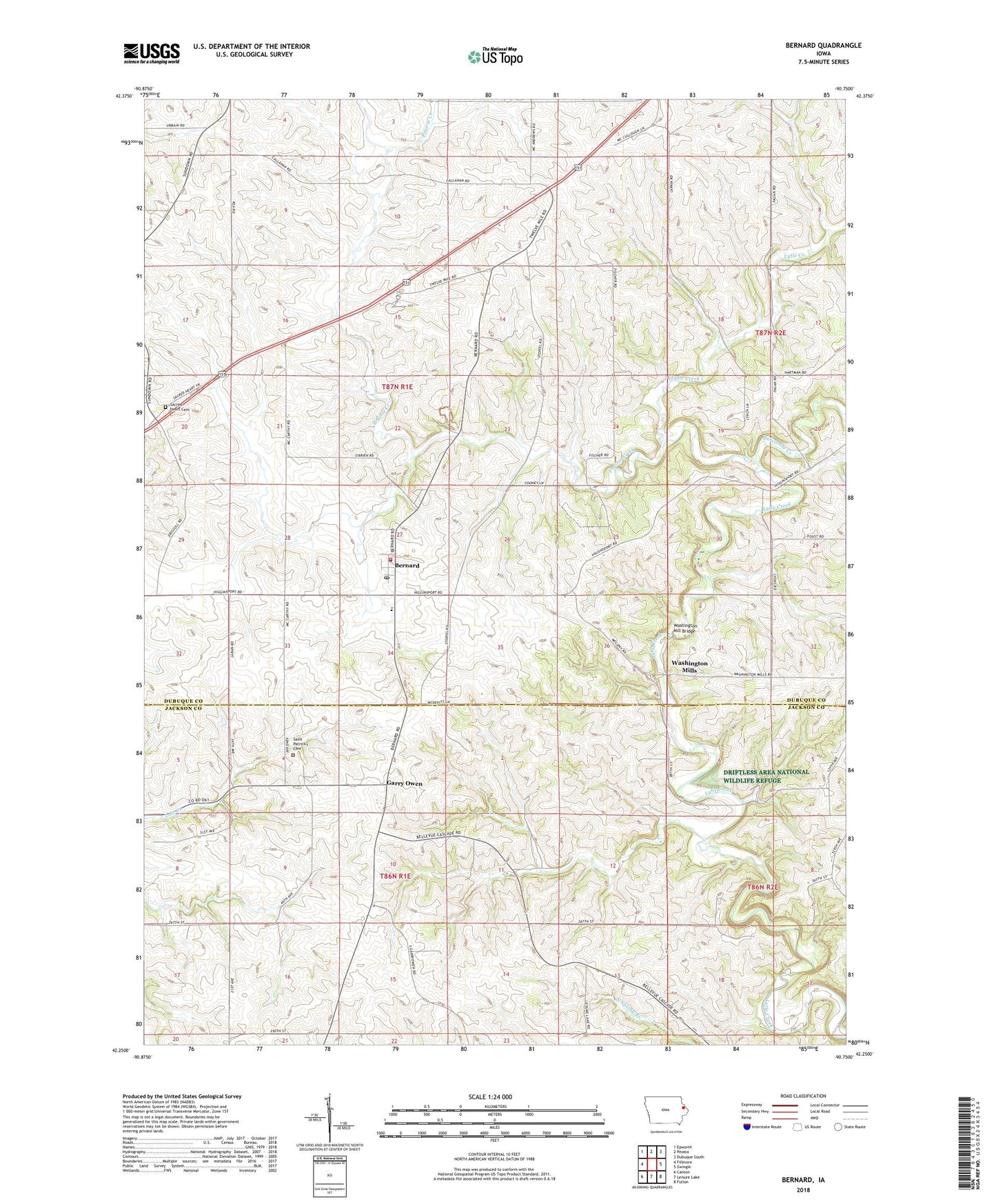
2022 topographic map quadrangle Bernard in the state of Iowa. Scale: 1:24000. Based on the newly updated USGS 7.5' US Topo map series, this map is in the following counties: Dubuque, Jackson. The map contains contour data, water features, and other items you are used to seeing on USGS maps, but also has updated roads and other features. This is the next generation of topographic maps. Printed on high-quality waterproof paper with UV fade-resistant inks.
Quads adjacent to this one:
West: Fillmore
Northwest: Epworth
North: Peosta
Northeast: Dubuque South
East: Zwingle
Southeast: Fulton
South: Leisure Lake
Southwest: Canton
This map covers the same area as the classic USGS quad with code o42090c7.
Contains the following named places: Bernard, Bernard Elementary School, Bernard Fire Department, Bernard Post Office, Bernard Town Hall, Buncombe Creek, City of Bernard, Donelan POst Office, Garry Owen, Garry Owen Post Office, Melleray, Melleray Post Office, Prairie Creek, Prairie Creek Post Office, Sacred Heart Cemetery, Sacred Heart Church, Sacred Heart School, Saint Patrick School, Saint Patricks Cemetery, Saint Patricks Church, Theisen Creek, Township of Butler, Township of Prairie Creek, Washington Mill Bridge, Washington Mills, Washington Mills Post Office, ZIP Code: 52032