MyTopo
Exira West Iowa US Topo Map
Couldn't load pickup availability
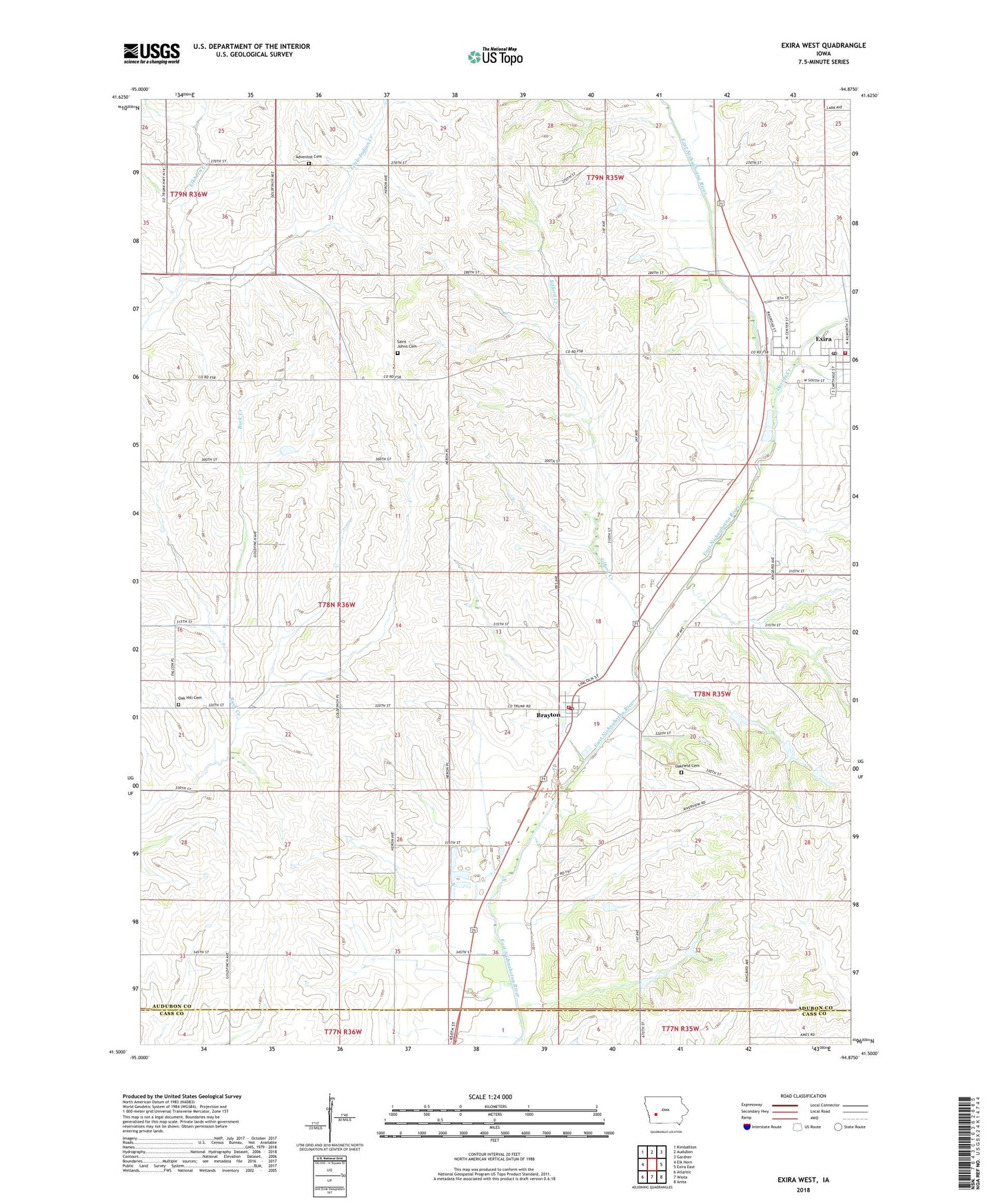
2022 topographic map quadrangle Exira West in the state of Iowa. Scale: 1:24000. Based on the newly updated USGS 7.5' US Topo map series, this map is in the following counties: Audubon, Cass. The map contains contour data, water features, and other items you are used to seeing on USGS maps, but also has updated roads and other features. This is the next generation of topographic maps. Printed on high-quality waterproof paper with UV fade-resistant inks.
Quads adjacent to this one:
West: Elk Horn
Northwest: Kimballton
North: Audubon
Northeast: Gardner
East: Exira East
Southeast: Anita
South: Wiota
Southwest: Atlantic
This map covers the same area as the classic USGS quad with code o41094e8.
Contains the following named places: Adventist Cemetery, Adventist Church, Brayton, Brayton Lutheran Church, Brayton Post Office, Brayton Town Hall, Brayton Volunteer Fire Department, City of Brayton, City of Exira, Davids Creek, Exira, Exira Care Center, Exira City Hall, Exira Family Medicine Clinic, Exira Fire Department, Exira Lutheran Church, Exira Police Department, Exira Post Office, Exira Public Library, Exira Recreational Center, First Baptist Church, Little Elkhorn Creek, Little Indian Creek, Louisville Post Office, Oak Hill Cemetery, Oak Hill Church, Oakfield, Oakfield Cemetery, Oakfield Post Office, Plow-in-Oak Park, Saint Johns Cemetery, Saint Johns Church, Sifford Creek, Township of Oakfield, West Central Cooperative Elevator, ZIP Code: 50042