MyTopo
Anita Iowa US Topo Map
Couldn't load pickup availability
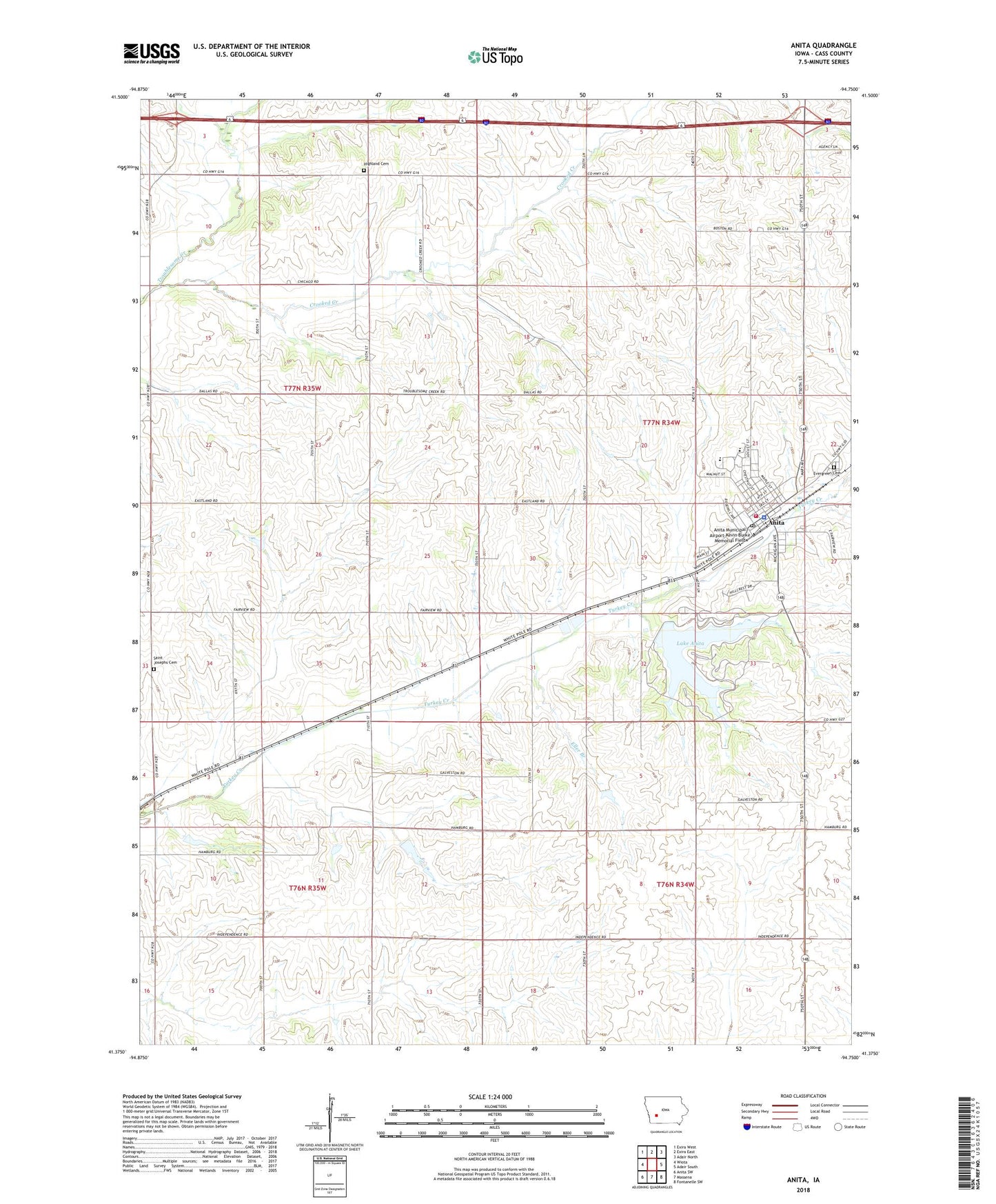
2022 topographic map quadrangle Anita in the state of Iowa. Scale: 1:24000. Based on the newly updated USGS 7.5' US Topo map series, this map is in the following counties: Cass. The map contains contour data, water features, and other items you are used to seeing on USGS maps, but also has updated roads and other features. This is the next generation of topographic maps. Printed on high-quality waterproof paper with UV fade-resistant inks.
Quads adjacent to this one:
West: Wiota
Northwest: Exira West
North: Exira East
Northeast: Adair North
East: Adair South
Southeast: Fontanelle SW
South: Massena
Southwest: Anita SW
This map covers the same area as the classic USGS quad with code o41094d7.
Contains the following named places: Anita, Anita City Hall, Anita Medical Center, Anita Municipal Airport-Kevin Burke Memorial Field, Anita Police Department, Anita Post Office, Anita Public Library, Anita United Methodist Church, Anita Volunteer Fire Department, Bandshell Park, Central Church of Christ, City of Anita, Colonial Manor, Congregational Church, Crestwood Golf Club, Crooked Creek, Cumberland Anita Massena High School, Cumberland Anita Massena North Elementary School, Evergreen Cemetery, Highland Cemetery, Holy Cross Lutheran Church, Keystone Park, Lake Anita, Lake Anita State Park, Lutheran Church, Saint Josephs Cemetery, Saint Marys Catholic Church, Township of Benton, Township of Grant, Troublesome Creek Wildlife Area, Victory Park, ZIP Code: 50274