MyTopo
Kimballton Iowa US Topo Map
Couldn't load pickup availability
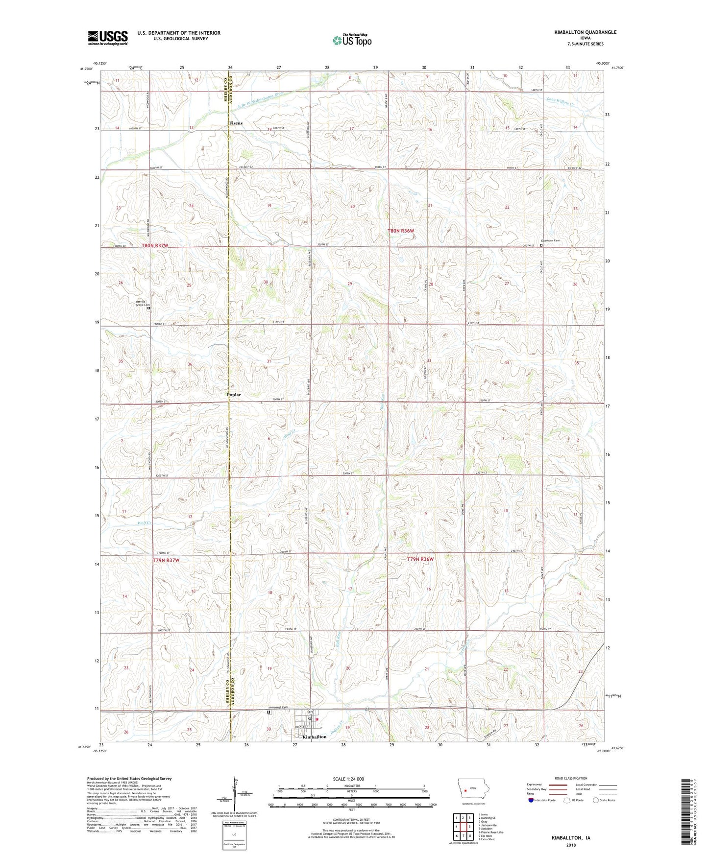
2022 topographic map quadrangle Kimballton in the state of Iowa. Scale: 1:24000. Based on the newly updated USGS 7.5' US Topo map series, this map is in the following counties: Audubon, Shelby. The map contains contour data, water features, and other items you are used to seeing on USGS maps, but also has updated roads and other features. This is the next generation of topographic maps. Printed on high-quality waterproof paper with UV fade-resistant inks.
Quads adjacent to this one:
West: Jacksonville
Northwest: Irwin
North: Manning SE
Northeast: Gray
East: Audubon
Southeast: Exira West
South: Elk Horn
Southwest: Prairie Rose Lake
This map covers the same area as the classic USGS quad with code o41095f1.
Contains the following named places: Bethany Lutheran Church, Bull Run, City of Kimballton, Ebenezer Cemetery, Ebenezer Church, Edwards County Park, Fiscus, Fiscus Post Office, General Store Museum, Immanuel Cemetery, Immanuel Lutheran Church, Kimballton, Kimballton City Fire Department, Kimballton Library, Kimballton Post Office, Kimballton Town Hall, Little Mermaid Statue, Merrills Grove Cemetery, Poplar, Poplar Cemetery, Poplar Post Office, Township of Douglas, Township of Sharon, Zinke Farm, ZIP Code: 51543