MyTopo
Farnhamville Iowa US Topo Map
Couldn't load pickup availability
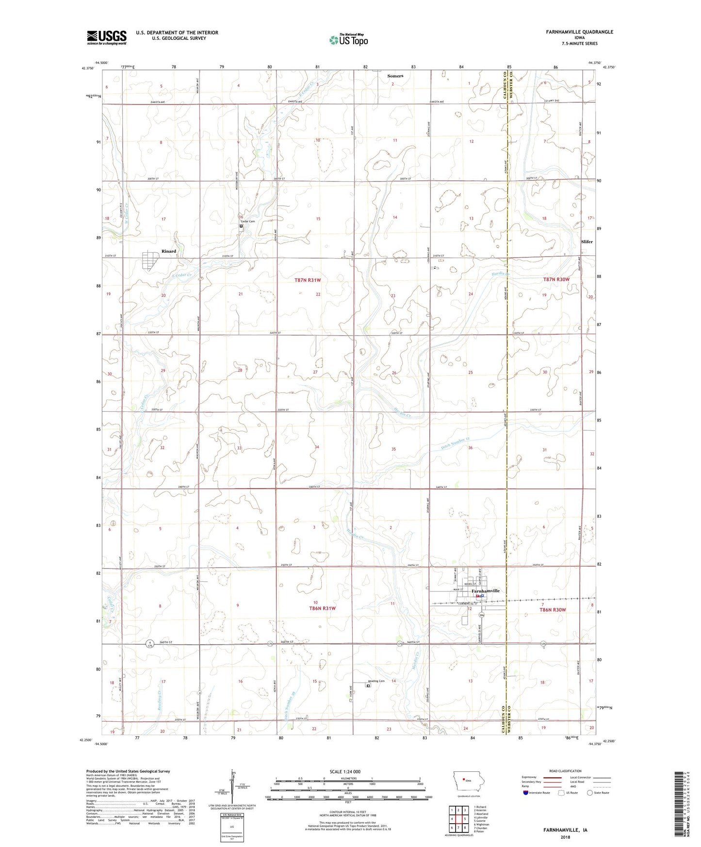
2022 topographic map quadrangle Farnhamville in the state of Iowa. Scale: 1:24000. Based on the newly updated USGS 7.5' US Topo map series, this map is in the following counties: Calhoun, Webster. The map contains contour data, water features, and other items you are used to seeing on USGS maps, but also has updated roads and other features. This is the next generation of topographic maps. Printed on high-quality waterproof paper with UV fade-resistant inks.
Quads adjacent to this one:
West: Lohrville
Northwest: Richard
North: Knierim
Northeast: Moorland
East: Gowrie
Southeast: Paton
South: Churdan
Southwest: Wightman
This map covers the same area as the classic USGS quad with code o42094c4.
Contains the following named places: Cedar Cemetery, Cedar Wildlife Area, City of Farnhamville, City of Rinard, Davis Preservation Area, Ditch Number 12, Easley, Farmers Cooperative Company Elevator, Farnhamville, Farnhamville Fire Department, Farnhamville Library, Farnhamville Police Department, Farnhamville Post Office, Farnhamville Town Hall, First United Church, Holy Trinity Lutheran Church, Lohr Wildlife Refuge, Muddy, Muddy Post Office, Prairie Valley Elementary School, Prairie Valley Middle School, Reading Cemetery, Rinard, Rinard Post Office, Slifer, Slifer Post Office, Township of Cedar, Township of Reading, Welshs Slough, ZIP Code: 50538