MyTopo
Moorland Iowa US Topo Map
Couldn't load pickup availability
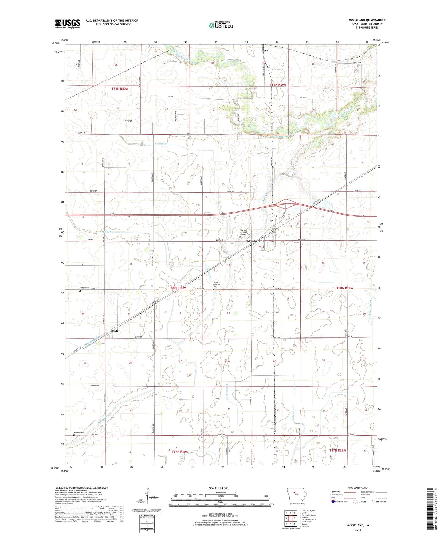
2022 topographic map quadrangle Moorland in the state of Iowa. Scale: 1:24000. Based on the newly updated USGS 7.5' US Topo map series, this map is in the following counties: Webster. The map contains contour data, water features, and other items you are used to seeing on USGS maps, but also has updated roads and other features. This is the next generation of topographic maps. Printed on high-quality waterproof paper with UV fade-resistant inks.
Quads adjacent to this one:
West: Knierim
Northwest: Gilmore City SW
North: Clare
Northeast: Fort Dodge North
East: Fort Dodge South
Southeast: Harcourt
South: Gowrie
Southwest: Farnhamville
This map covers the same area as the classic USGS quad with code o42094d3.
Contains the following named places: City of Moorland, Congregational Church, Fulton Cemetery, Fulton Lutheran Church, Fulton Township Cemetery, Lizard Creek State Recreation Area, McLaughlin's Grove Post Office, Mizpah Cemetery, Moorland, Moorland City Community Center, Moorland Fire Department, Moorland Pond Park, Moorland Post Office, Nesler Field, New Cooperative Incorporated Elevator, Our Lady of Good Council Cemetery, Our Lady of Good Counsel Church, Prairie Creek, Roelyn, Roelyn Post Office, Spring Creek, Tara Post Office, Township of Fulton, ZIP Code: 50566