MyTopo
Fertile Iowa US Topo Map
Couldn't load pickup availability
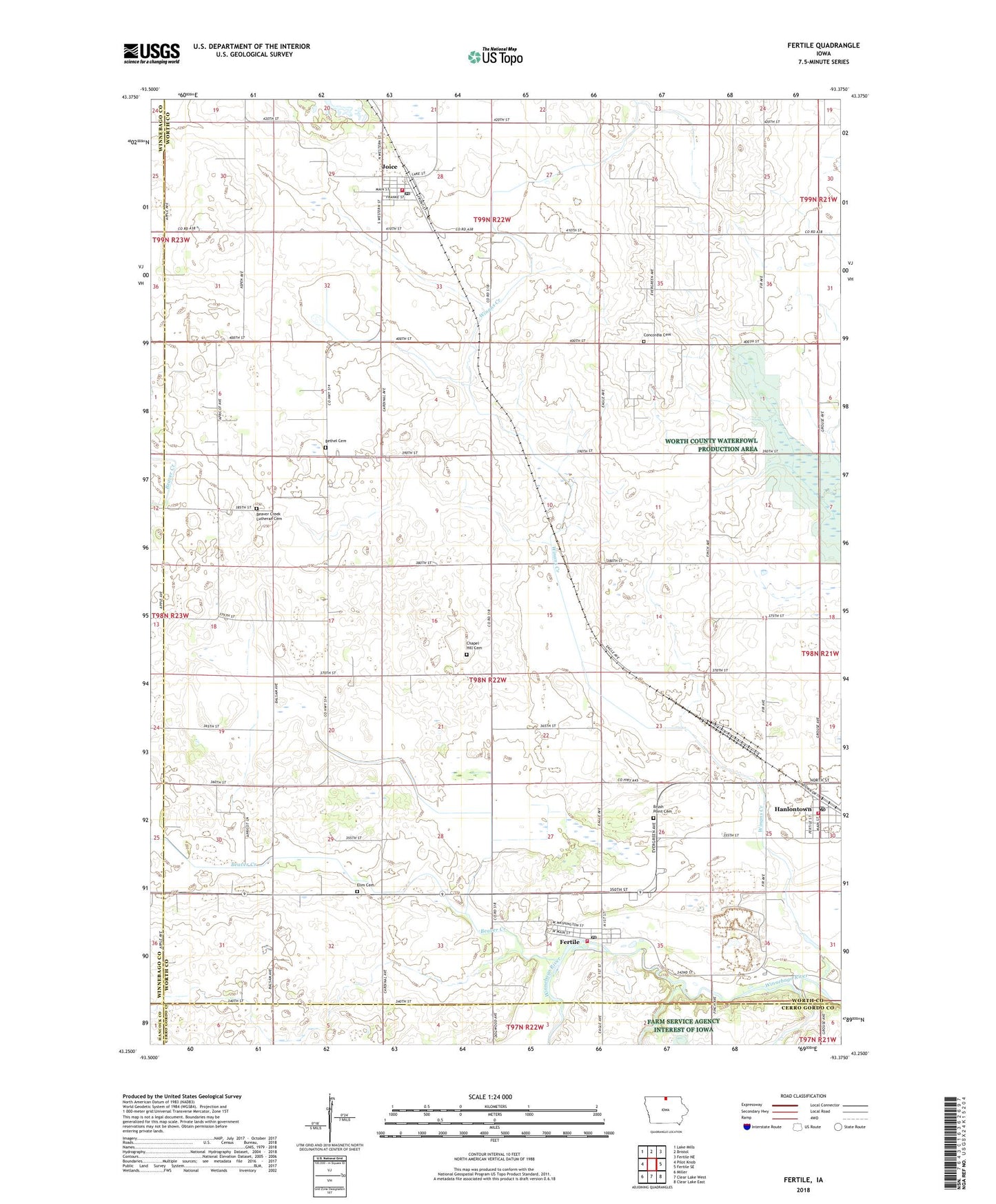
2022 topographic map quadrangle Fertile in the state of Iowa. Scale: 1:24000. Based on the newly updated USGS 7.5' US Topo map series, this map is in the following counties: Worth, Cerro Gordo, Winnebago, Hancock. The map contains contour data, water features, and other items you are used to seeing on USGS maps, but also has updated roads and other features. This is the next generation of topographic maps. Printed on high-quality waterproof paper with UV fade-resistant inks.
Quads adjacent to this one:
West: Pilot Knob
Northwest: Lake Mills
North: Bristol
Northeast: Fertile NE
East: Fertile SE
Southeast: Clear Lake East
South: Clear Lake West
Southwest: Miller
This map covers the same area as the classic USGS quad with code o43093c4.
Contains the following named places: Beaver Creek, Beaver Creek Church, Beaver Creek Lutheran Cemetery, Bethany Lutheran Church, Bethel Cemetery, Bethel Church, Brush Point Cemetery, Chapel Hill Cemetery, Church of Christ, City of Fertile, City of Hanlontown, City of Joice, Concordia Cemetery, Elim Cemetery, Fertile, Fertile Community Center, Fertile Fire Department, Fertile Post Office, Fertile Public Library, Fertile Quarry, First Lutheran Church, Grace Lutheran Church, Grafton Post Office, Hanlontown, Hanlontown Elementary School, Hanlontown Post Office, Hanlontown Volunteer Fire Department, Haugen Timber County Park, Joice, Joice Fire Department, Joice Post Office, Joice Public Library, Kinney Memorial Library, Lark, Lark Post Office, Nordland, Nordland Post Office, Storre Wildlife Area, Top of Iowa Cooperative Elevator, Township of Fertile, Wallys Woods, Winans Creek, Worth County Waterfowl Production Area, ZIP Codes: 50434, 50444, 50446