MyTopo
Clear Lake East Iowa US Topo Map
Couldn't load pickup availability
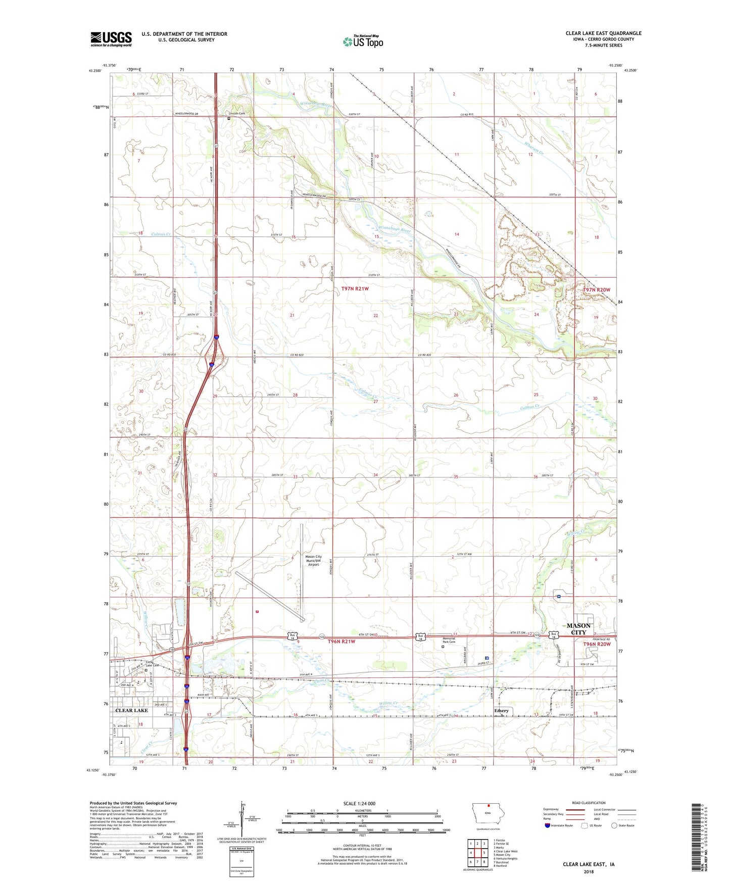
2022 topographic map quadrangle Clear Lake East in the state of Iowa. Scale: 1:24000. Based on the newly updated USGS 7.5' US Topo map series, this map is in the following counties: Cerro Gordo. The map contains contour data, water features, and other items you are used to seeing on USGS maps, but also has updated roads and other features. This is the next generation of topographic maps. Printed on high-quality waterproof paper with UV fade-resistant inks.
Quads adjacent to this one:
West: Clear Lake West
Northwest: Fertile
North: Fertile SE
Northeast: Manly
East: Mason City
Southeast: Hanford
South: Burchinal
Southwest: Ventura Heights
This map covers the same area as the classic USGS quad with code o43093b3.
Contains the following named places: Blair Meadows Preserve, Cerro Gordo County Home, Church of Christ, City of Clear Lake, Clear Creek, Clear Creek Elementary School, Clear Lake Cemetery, Clear Lake High School, Clear Lake Middle School, Clear Lake State Game Management Area, Community of Christ Church, Crane Creek, Creamery, Creamery Post Office, Emery, Emery Post Office, Farmers Co-op Elevator, Fieldstone Park, Galilean Lutheran Church, Guardian Angel Roadside Chapel, Historic Northern Iowa State Historical Marker, I-35 Speedway, Interstate Grain Incorporated Elevator, Iowa Trolley Park, Jehovahs Witnesses Kingdom Hall, Kingfisher Hollow Access, Kinney Pioneer Museum, Lincoln Cemetery, Lincoln Townhall, Marion Park, Mason City Municipal Airport, Mason City Municipal Airport Fire Department, Memorial Park Cemetery, Mental Health Center of North Iowa Incorporated, Mercy Family Care Center - Clear Lake, Mercy Medical Center - North Iowa West Campus, North Iowa Christian School, North Iowa Fairgrounds, North Iowa Mercy Health Center - West Campus, Orchard Park Mobile Home Court, Pediatric and Adolescent Clinic, Registry Park, Rest Area 37, Rest Area 38, River City Greenbelt Trail System, Rock Post Office, Township of Lincoln, Wheelerwood, Wheelerwood Post Office, Winnebago Heights, Zion Lutheran Church