MyTopo
Floris Iowa US Topo Map
Couldn't load pickup availability
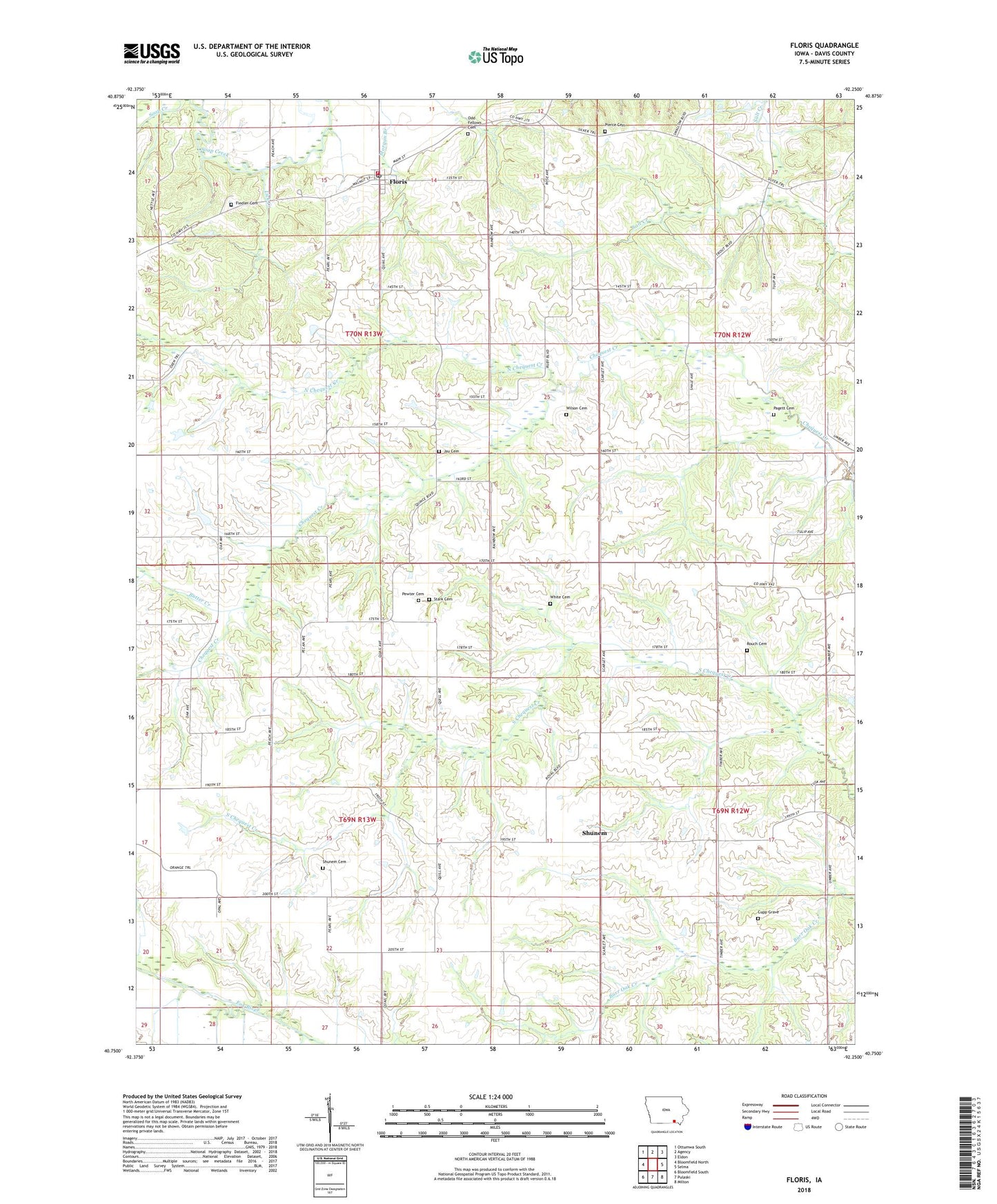
2022 topographic map quadrangle Floris in the state of Iowa. Scale: 1:24000. Based on the newly updated USGS 7.5' US Topo map series, this map is in the following counties: Davis. The map contains contour data, water features, and other items you are used to seeing on USGS maps, but also has updated roads and other features. This is the next generation of topographic maps. Printed on high-quality waterproof paper with UV fade-resistant inks.
Quads adjacent to this one:
West: Bloomfield North
Northwest: Ottumwa South
North: Agency
Northeast: Eldon
East: Selma
Southeast: Milton
South: Pulaski
Southwest: Bloomfield South
This map covers the same area as the classic USGS quad with code o40092g3.
Contains the following named places: Butter Creek, City of Floris, Cupp Grave, Fiedler Cemetery, Floris, Floris Baptist Church, Floris Cemetery, Floris City Hall, Floris Fire Department, Floris Park, Floris Post Office, Hooper Field, Jay Cemetery, Lick Creek, Locust Grove Church, North Chequest Creek, Pagett Cemetery, Pewter Cemetery, Pierce Cemetery, Rouch Cemetery, Salt Creek Post Office, Shunem, Shunem Cemetery, Stark Cemetery, Township of Lick Creek, Township of Perry, Twin Ridge Farms, White Cemetery, Wilson Cemetery