MyTopo
Agency Iowa US Topo Map
Couldn't load pickup availability
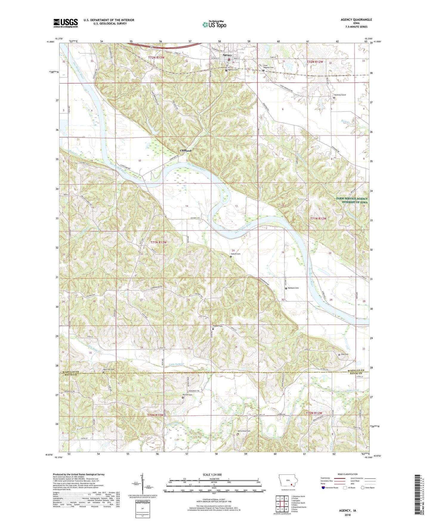
2022 topographic map quadrangle Agency in the state of Iowa. Scale: 1:24000. Based on the newly updated USGS 7.5' US Topo map series, this map is in the following counties: Wapello, Davis. The map contains contour data, water features, and other items you are used to seeing on USGS maps, but also has updated roads and other features. This is the next generation of topographic maps. Printed on high-quality waterproof paper with UV fade-resistant inks.
Quads adjacent to this one:
West: Ottumwa South
Northwest: Ottumwa North
North: Farson
Northeast: Abingdon
East: Eldon
Southeast: Selma
South: Floris
Southwest: Bloomfield North
This map covers the same area as the classic USGS quad with code o40092h3.
Contains the following named places: Agency, Agency Cemetery, Agency City Hall, Agency Post Office, Agency Public Library, Agency United Methodist Church, Agency Volunteer Fire and Rescue Department, Alpine, Alpine Log Church, Alpine Post Office, Bethlehem Church, Betterton School, Camp Arrowhead, Chief Wapello Cemetery, Chief Wapello's Grave Historical Marker, City of Agency, Cliff Land, Cliffland, Cliffland Post Office, Cliffland River Access, Fiedler Cemetery, Fiedler School, Fox Hills Wildlife Management Area, Hackney Grave, Hubler School, Laddsdale, Laddsdale Post Office, Little Soap Creek, Mars Hill Cemetery, Mars Hill Church, McCormick Cemetery, Miller Chapel, Morgan Branch, New Laddsdale Woodland Retreat, New Life Family Church, O'Connor School, Parrott Cemetery, Pleasant Grove School, Pleasant Hill School, Railback Cemetery, Salt Creek, Salt Creek School, Sedore Cemetery, Shank School, Sioc Cemetery, Township of Agency, Township of Keokuk, Turkey Creek, Village Creek, ZIP Code: 52530