MyTopo
Bloomfield South Iowa US Topo Map
Couldn't load pickup availability
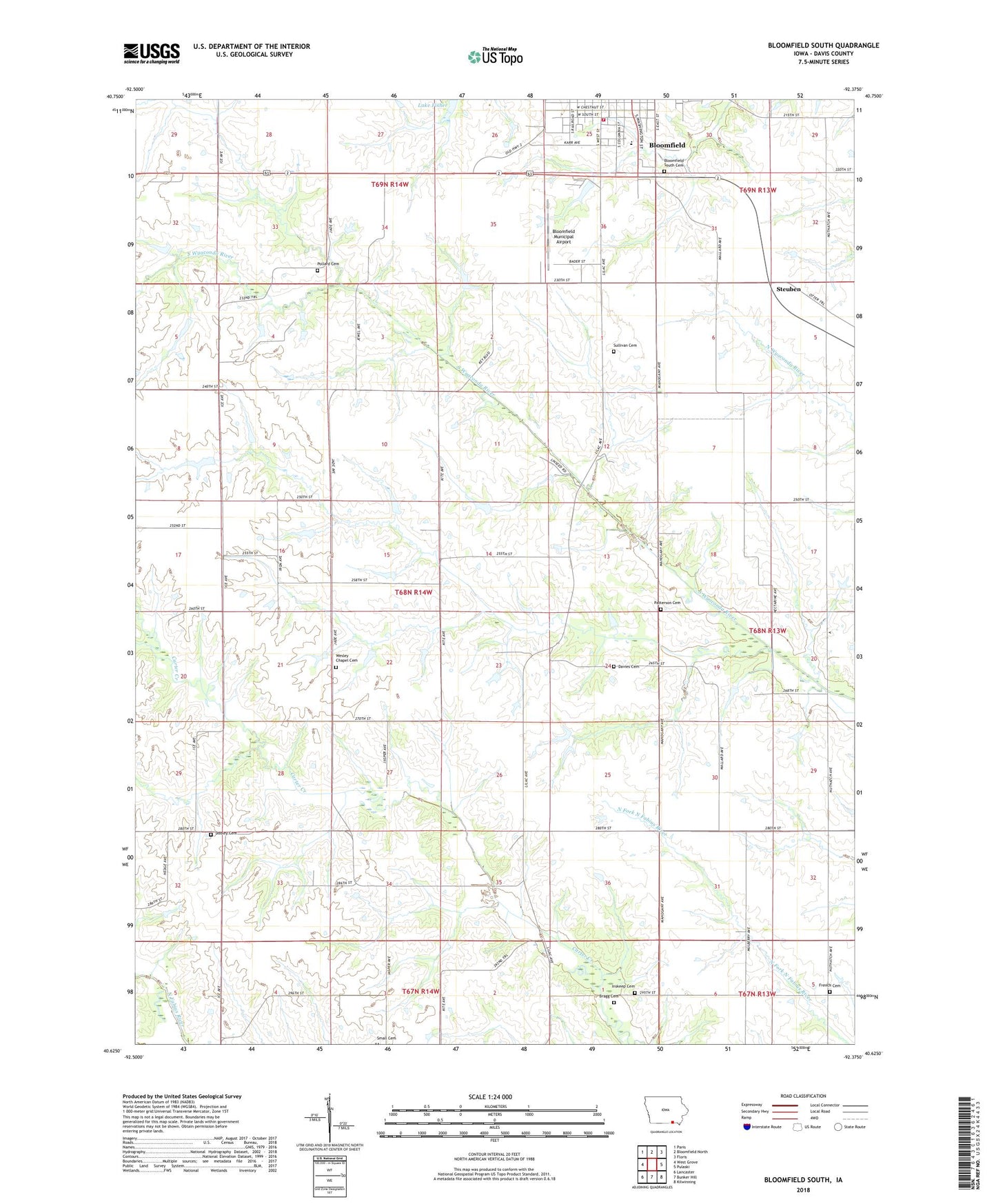
2022 topographic map quadrangle Bloomfield South in the state of Iowa. Scale: 1:24000. Based on the newly updated USGS 7.5' US Topo map series, this map is in the following counties: Davis. The map contains contour data, water features, and other items you are used to seeing on USGS maps, but also has updated roads and other features. This is the next generation of topographic maps. Printed on high-quality waterproof paper with UV fade-resistant inks.
Quads adjacent to this one:
West: West Grove
Northwest: Paris
North: Bloomfield North
Northeast: Floris
East: Pulaski
Southeast: Kilwinning
South: Bunker Hill
Southwest: Lancaster
This map covers the same area as the classic USGS quad with code o40092f4.
Contains the following named places: Bloomfield, Bloomfield Agri-Center Elevator, Bloomfield Municipal Airport, Bloomfield South Cemetery, Bloomfield Volunteer Fire Department, Bragg Cemetery, Church of the Open Bible, City of Bloomfield, Davies Cemetery, Davis County, Davis County Flex - Ed High School, Davis County Sheriff's Office, Dooley Cemetery, French Cemetery, Inskeep Cemetery, McGowen Recreation and Wildlife Area, Patterson Cemetery, Pollard Cemetery, Steuben, Sullivan Cemetery, Township of Cleveland, Township of Wyacondah, Wesley Chapel Cemetery, ZIP Code: 52537