MyTopo
Pomeroy Iowa US Topo Map
Couldn't load pickup availability
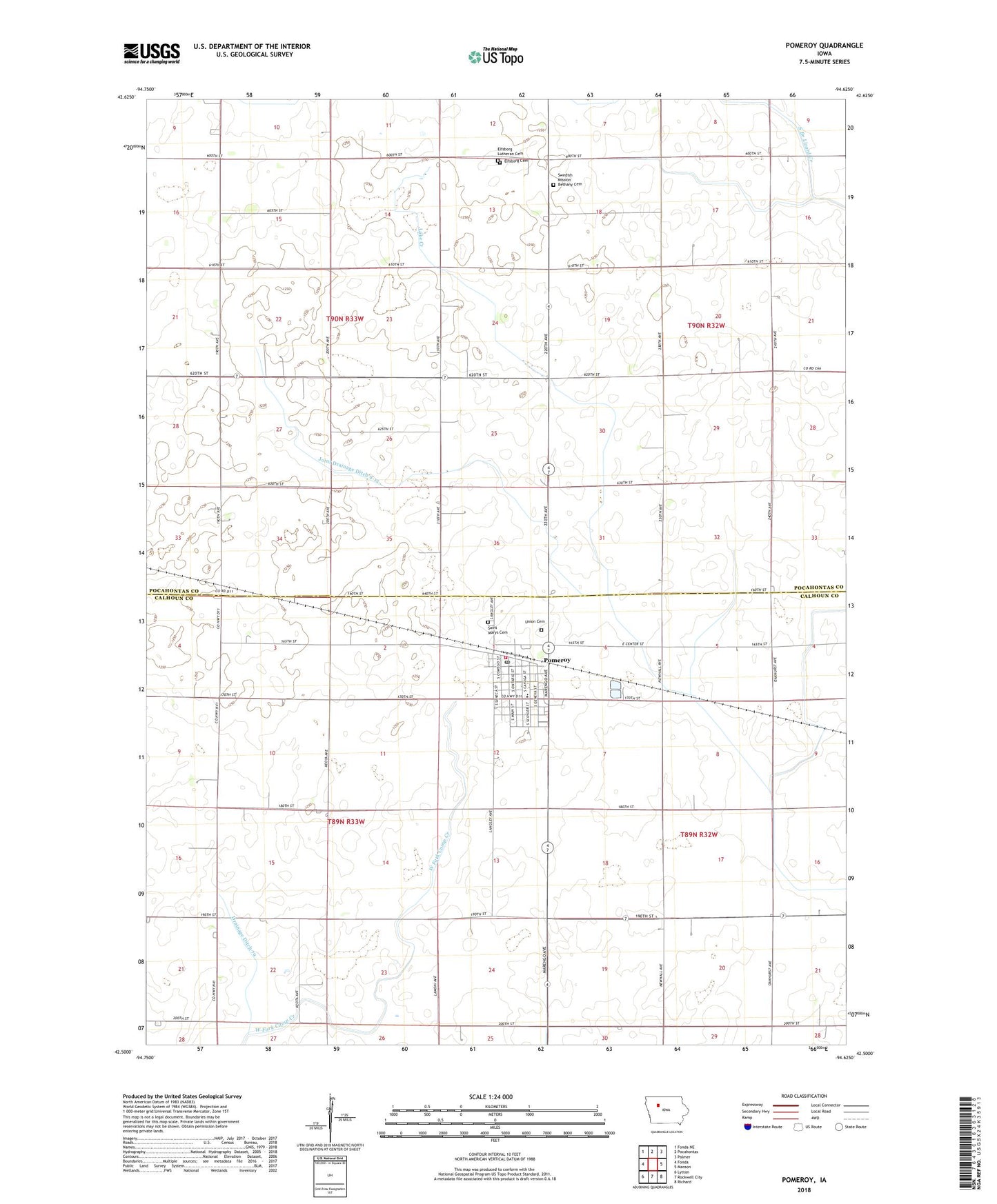
2022 topographic map quadrangle Pomeroy in the state of Iowa. Scale: 1:24000. Based on the newly updated USGS 7.5' US Topo map series, this map is in the following counties: Pocahontas, Calhoun. The map contains contour data, water features, and other items you are used to seeing on USGS maps, but also has updated roads and other features. This is the next generation of topographic maps. Printed on high-quality waterproof paper with UV fade-resistant inks.
Quads adjacent to this one:
West: Fonda
Northwest: Fonda NE
North: Pocahontas
Northeast: Palmer
East: Manson
Southeast: Richard
South: Rockwell City
Southwest: Lytton
This map covers the same area as the classic USGS quad with code o42094e6.
Contains the following named places: City of Pomeroy, Colfax Township Hall, Drainage Ditch 157, Drainage Ditch 66, Drainage Ditch 79, Elfsborg Church, Elfsborg Lutheran Cemetery, Evangelical Covenant Church, First United Church of Christ, Immanuel Lutheran Church, Joint Drainage Ditch 9-13, KTLB-FM (Twin Lakes), Pomeroy, Pomeroy Care Center, Pomeroy City Hall, Pomeroy Elementary School, Pomeroy Fire and Ambulance Service, Pomeroy Post Office, Pomeroy Public Library, Rhodes Clinic, Saint John Lutheran Church, Saint Mary's Catholic Church, Saint Marys Cemetery, Swedish Mission Bethany Cemetery, Township of Butler, Township of Colfax, Union Cemetery, Wesley United Methodist Church, ZIP Code: 50575