MyTopo
Fort Atkinson Iowa US Topo Map
Couldn't load pickup availability
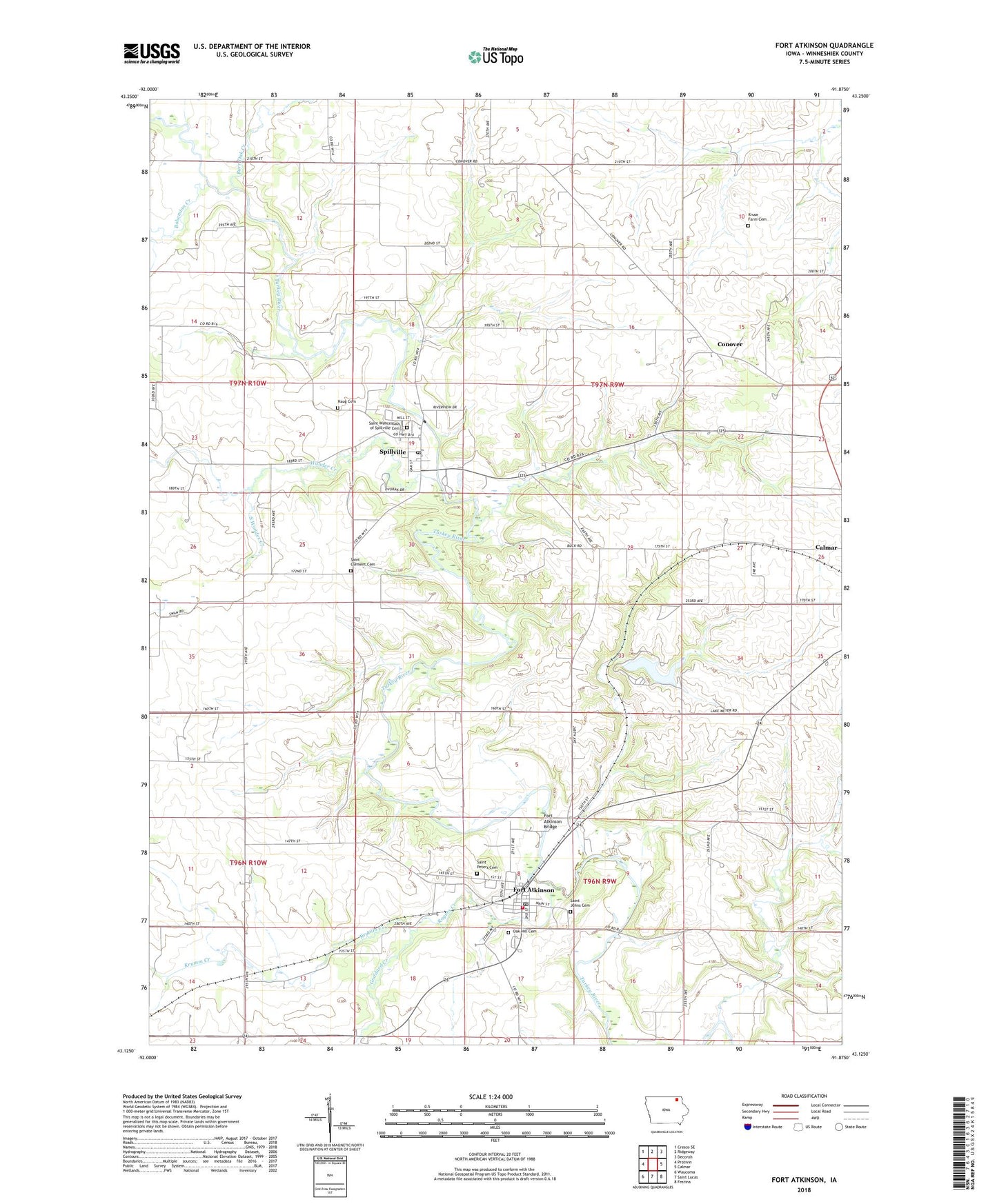
2022 topographic map quadrangle Fort Atkinson in the state of Iowa. Scale: 1:24000. Based on the newly updated USGS 7.5' US Topo map series, this map is in the following counties: Winneshiek. The map contains contour data, water features, and other items you are used to seeing on USGS maps, but also has updated roads and other features. This is the next generation of topographic maps. Printed on high-quality waterproof paper with UV fade-resistant inks.
Quads adjacent to this one:
West: Protivin
Northwest: Cresco SE
North: Ridgeway
Northeast: Decorah
East: Calmar
Southeast: Festina
South: Saint Lucas
Southwest: Waucoma
This map covers the same area as the classic USGS quad with code o43091b8.
Contains the following named places: Bily Clocks Museum, Bohemian Creek, Bouska Log School, Burr Oak Creek, City of Fort Atkinson, City of Spillville, Conover, Conover Post Office, Fort Atkinson, Fort Atkinson Bridge, Fort Atkinson City Park, Fort Atkinson Fire Department, Fort Atkinson Historical Marker, Fort Atkinson Post Office, Fort Atkinson Public Library, Fort Atkinson State Preserve, Goddard Creek, Haug Cemetery, Krumm Creek, Kruse Farm Cemetery, Lake Meyer, Lake Meyer County Park, Lake Meyer Dam, Ludwig Reserve, Lutheran Chapel of Saint James German, Oak Hill Cemetery, Riverside Park, Rogers Creek, Saint Clement Cemetery, Saint Clements Church, Saint James Lutheran Church State Preserve, Saint John Nepomucene Catholic Church, Saint Johns Cemetery, Saint Peters Cemetery, Saint Wenceslaus Catholic Church, Saint Wenceslaus Cemetery, Saint Wenceslaus School, South Winn Golf Course, South Winneshiek Area First Responders Fort Atkinson, South Winneshiek Area First Responders Spillville, South Wonder Creek, Spillville, Spillville Post Office, Spillville Public Library, Township of Calmar, Township of Washington, Wonder Creek, ZIP Codes: 52132, 52144, 52168