MyTopo
Ridgeway Iowa US Topo Map
Couldn't load pickup availability
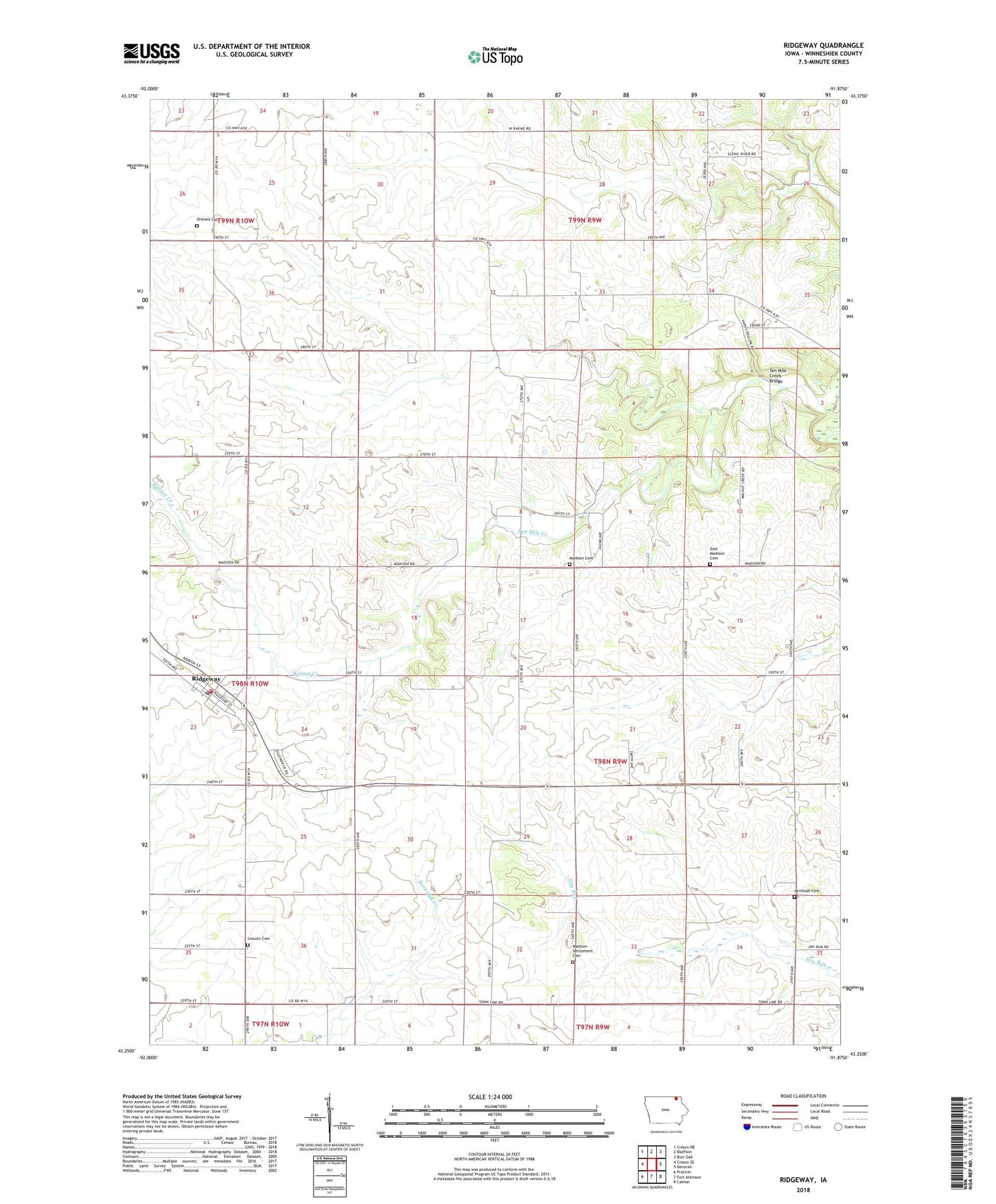
2022 topographic map quadrangle Ridgeway in the state of Iowa. Scale: 1:24000. Based on the newly updated USGS 7.5' US Topo map series, this map is in the following counties: Winneshiek. The map contains contour data, water features, and other items you are used to seeing on USGS maps, but also has updated roads and other features. This is the next generation of topographic maps. Printed on high-quality waterproof paper with UV fade-resistant inks.
Quads adjacent to this one:
West: Cresco SE
Northwest: Cresco NE
North: Bluffton
Northeast: Burr Oak
East: Decorah
Southeast: Calmar
South: Fort Atkinson
Southwest: Protivin
This map covers the same area as the classic USGS quad with code o43091c8.
Contains the following named places: Burr Oak Springs Post Office, City of Ridgeway, Lincoln Cemetery, Madison Cemetery, Madison Church, Madison Lutheran Church East Cemetery, Madison Settlement Cemetery, McIntosh Cemetery, Orleans Church, Orleans Lutheran Church Cemetery, Peace Lutheran Church, Prairie Farmer Recreational Trail, Ridgeway, Ridgeway Elementary School, Ridgeway Fire Department, Ridgeway Post Office, Ridgeway Roadside Park, Ridgeway Town Hall, Ten Mile Creek Bridge, Township of Madison, Walnut Creek, ZIP Code: 52165