MyTopo
Protivin Iowa US Topo Map
Couldn't load pickup availability
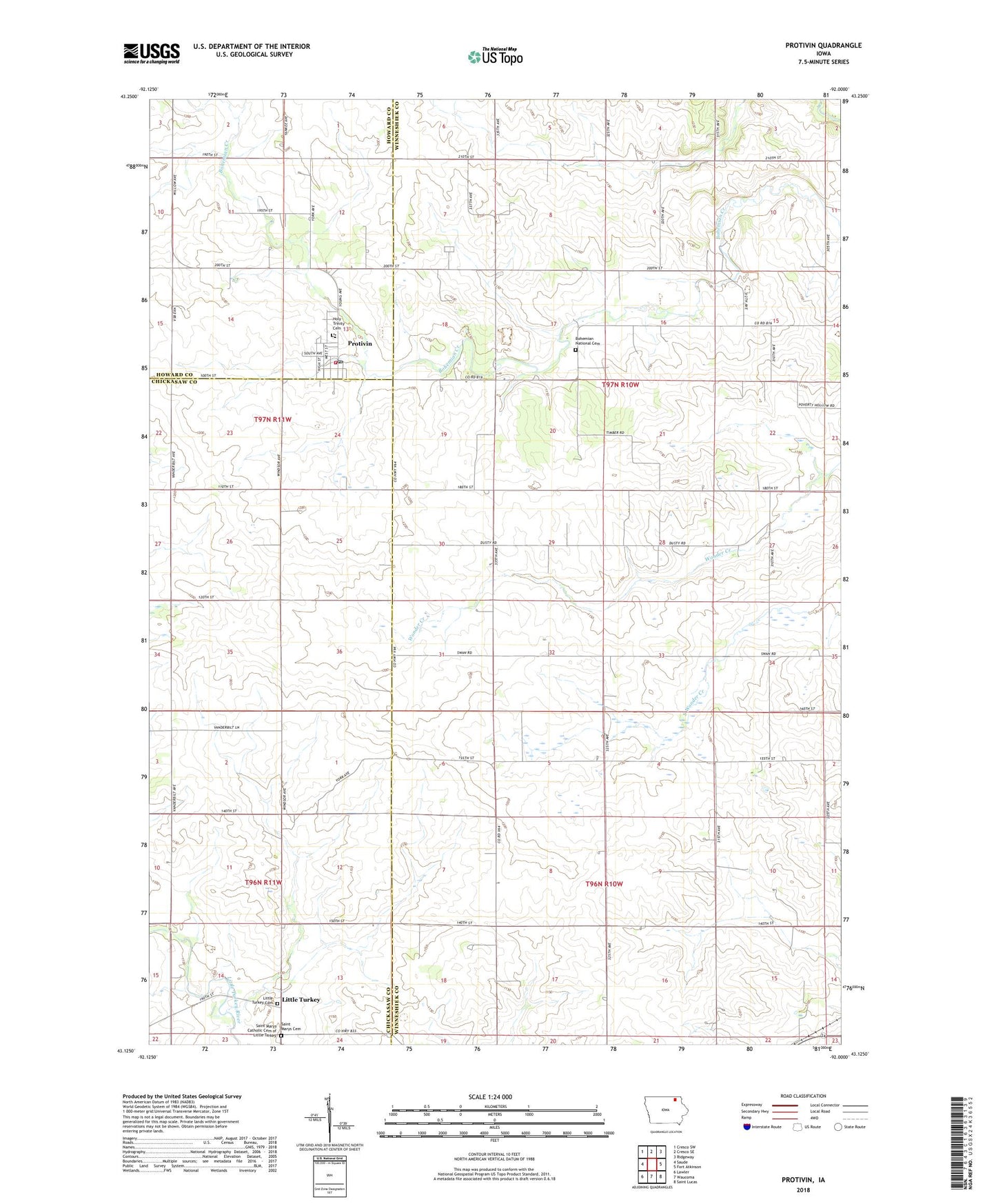
2022 topographic map quadrangle Protivin in the state of Iowa. Scale: 1:24000. Based on the newly updated USGS 7.5' US Topo map series, this map is in the following counties: Winneshiek, Chickasaw, Howard. The map contains contour data, water features, and other items you are used to seeing on USGS maps, but also has updated roads and other features. This is the next generation of topographic maps. Printed on high-quality waterproof paper with UV fade-resistant inks.
Quads adjacent to this one:
West: Saude
Northwest: Cresco SW
North: Cresco SE
Northeast: Ridgeway
East: Fort Atkinson
Southeast: Saint Lucas
South: Waucoma
Southwest: Lawler
This map covers the same area as the classic USGS quad with code o43092b1.
Contains the following named places: Albertson Farms, Bohemian National Cemetery, Chipera Prairie Park, City of Protivin, Holy Trinity Cemetery, Holy Trinity Church, Jirak Airport, Little Turkey, Little Turkey Cemetery, Little Turkey Post Office, Little Turkey Townhall, Ludwig County Park, Protivin, Protivin City Hall, Protivin Fire Department, Protivin Post Office, Saint Marys Catholic Cemetery of Little Turkey, Saint Marys Cemetery, Saint Marys Church, Sluggo's Pond Park, Township of Jackson, Township of Sumner, Trinity Catholic School, ZIP Code: 52163