MyTopo
Miles Iowa US Topo Map
Couldn't load pickup availability
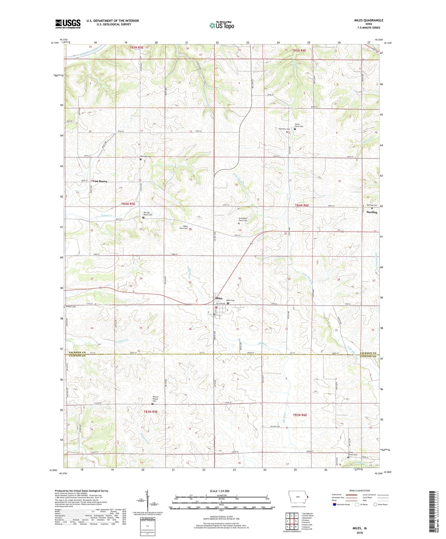
2022 topographic map quadrangle Miles in the state of Iowa. Scale: 1:24000. Based on the newly updated USGS 7.5' US Topo map series, this map is in the following counties: Jackson, Clinton. The map contains contour data, water features, and other items you are used to seeing on USGS maps, but also has updated roads and other features. This is the next generation of topographic maps. Printed on high-quality waterproof paper with UV fade-resistant inks.
Quads adjacent to this one:
West: Preston
Northwest: Springbrook
North: Green Island
Northeast: Blackhawk
East: Savanna
Southeast: Clinton NW
South: Andover
Southwest: Goose Lake
This map covers the same area as the classic USGS quad with code o42090a3.
Contains the following named places: Buckeye Cemetery, City of Miles, Community Ambulance Miles, Dalton Pond State Fishing Access Area, East Central Community High School, Easton Valley Elementary School, Fairview Cemetery, Horst Farm Cemetery, Methodist Church, Miles, Miles Cemetery, Miles Post Office, Miles Roadside Park, Miles Town Hall, Miles Volunteer Fire Department, Mount Algor Post Office, Old Van Buren Cemetery, Presbyterian Church, Schroeder Farm Cemetery, Sterling, Sterling Cemetery, Sterling Post Office, Teeds Grove Cemetery, Township of Iowa, Township of Van Buren, Van Buren, Vanburen Post Office, Vernon Prairie Cemetery, Watts Farm Cemetery, ZIP Code: 52064