MyTopo
Grant Iowa US Topo Map
Couldn't load pickup availability
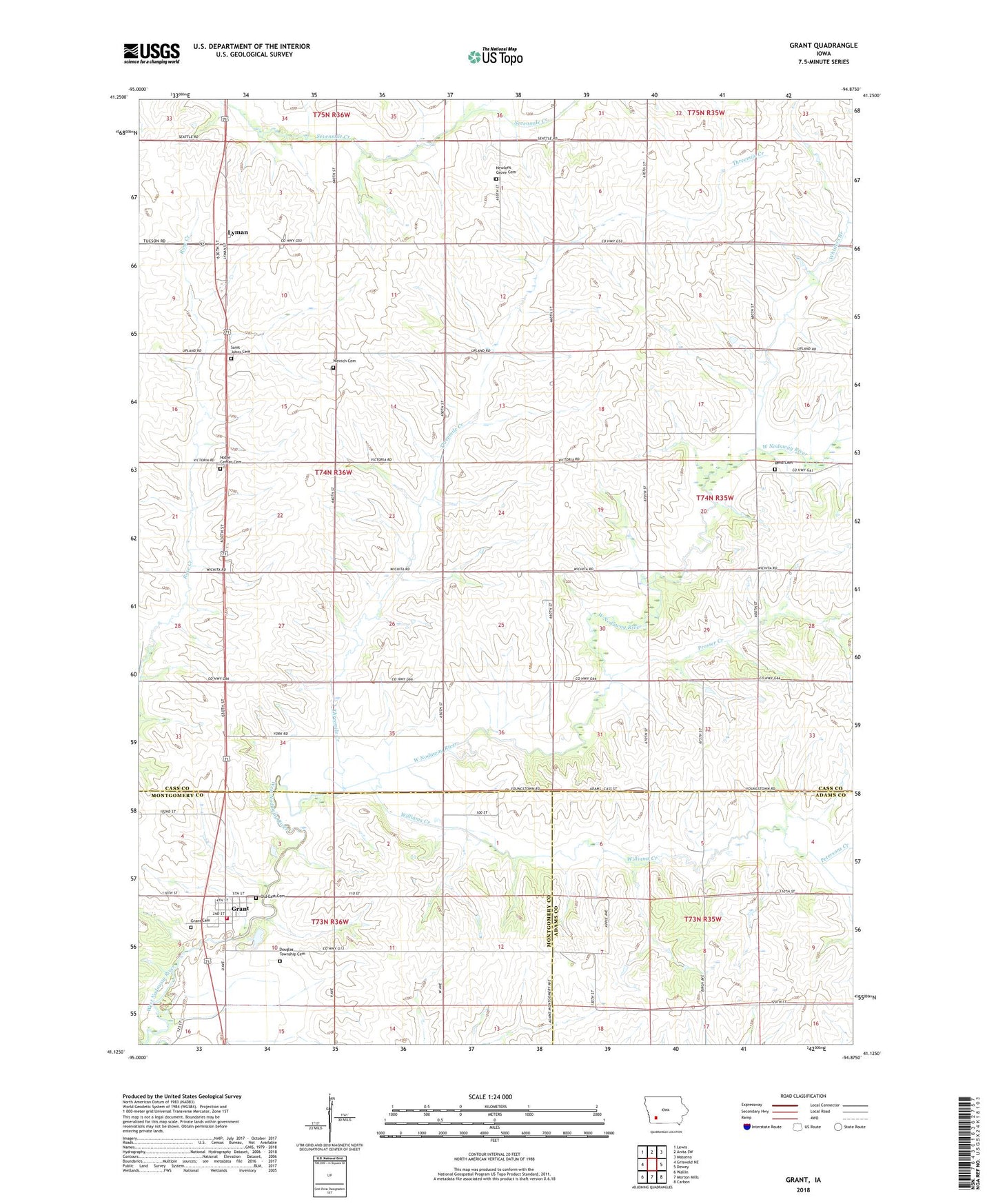
2022 topographic map quadrangle Grant in the state of Iowa. Scale: 1:24000. Based on the newly updated USGS 7.5' US Topo map series, this map is in the following counties: Cass, Montgomery, Adams. The map contains contour data, water features, and other items you are used to seeing on USGS maps, but also has updated roads and other features. This is the next generation of topographic maps. Printed on high-quality waterproof paper with UV fade-resistant inks.
Quads adjacent to this one:
West: Griswold NE
Northwest: Lewis
North: Anita SW
Northeast: Massena
East: Dewey
Southeast: Carbon
South: Morton Mills
Southwest: Wallin
This map covers the same area as the classic USGS quad with code o41094b8.
Contains the following named places: City of Grant, Douglas Township Cemetery, Grant, Grant Access, Grant Cemetery, Grant City Hall, Grant Fire Department, Grant Post Office, Lyman, Lyman Post Office, Newlons Grove Cemetery, Newlons Grove Post Office, Newtons Grove, Noble Center Cemetery, Noble Center Church, Old East Cemetery, Petersons Creek, Reno, Reno Cemetery, Reno Post Office, Saint Johns Cemetery, Saint Johns Church, Threemile Creek, Township of Noble, United Methodist Church, Weirich Cemetery, Whislers Branch, Williams Creek, ZIP Codes: 50843, 50847