MyTopo
Gray Iowa US Topo Map
Couldn't load pickup availability
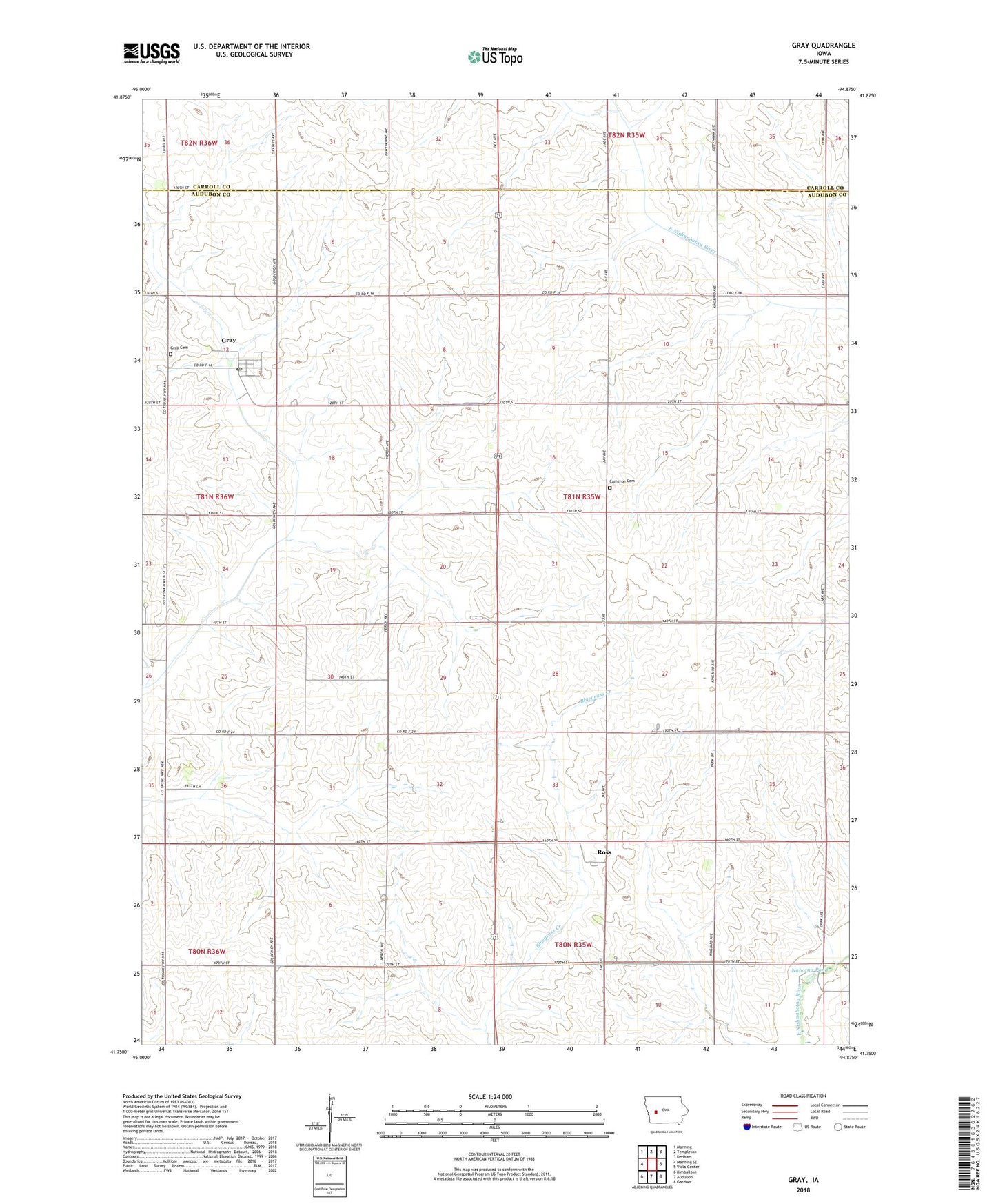
2022 topographic map quadrangle Gray in the state of Iowa. Scale: 1:24000. Based on the newly updated USGS 7.5' US Topo map series, this map is in the following counties: Audubon, Carroll. The map contains contour data, water features, and other items you are used to seeing on USGS maps, but also has updated roads and other features. This is the next generation of topographic maps. Printed on high-quality waterproof paper with UV fade-resistant inks.
Quads adjacent to this one:
West: Manning SE
Northwest: Manning
North: Templeton
Northeast: Dedham
East: Viola Center
Southeast: Gardner
South: Audubon
Southwest: Kimballton
This map covers the same area as the classic USGS quad with code o41094g8.
Contains the following named places: Cameron Cemetery, City of Gray, Gray, Gray Cemetery, Gray Post Office, Heritage Rose Garden, Jack Farms, Nabotna Pond, Nabotna Pond Park, Ross, Ross Post Office, Thompson, Thompson Post Office, Township of Cameron, Trinity Lutheran Church, ZIP Code: 50025