MyTopo
Grinnell North Iowa US Topo Map
Couldn't load pickup availability
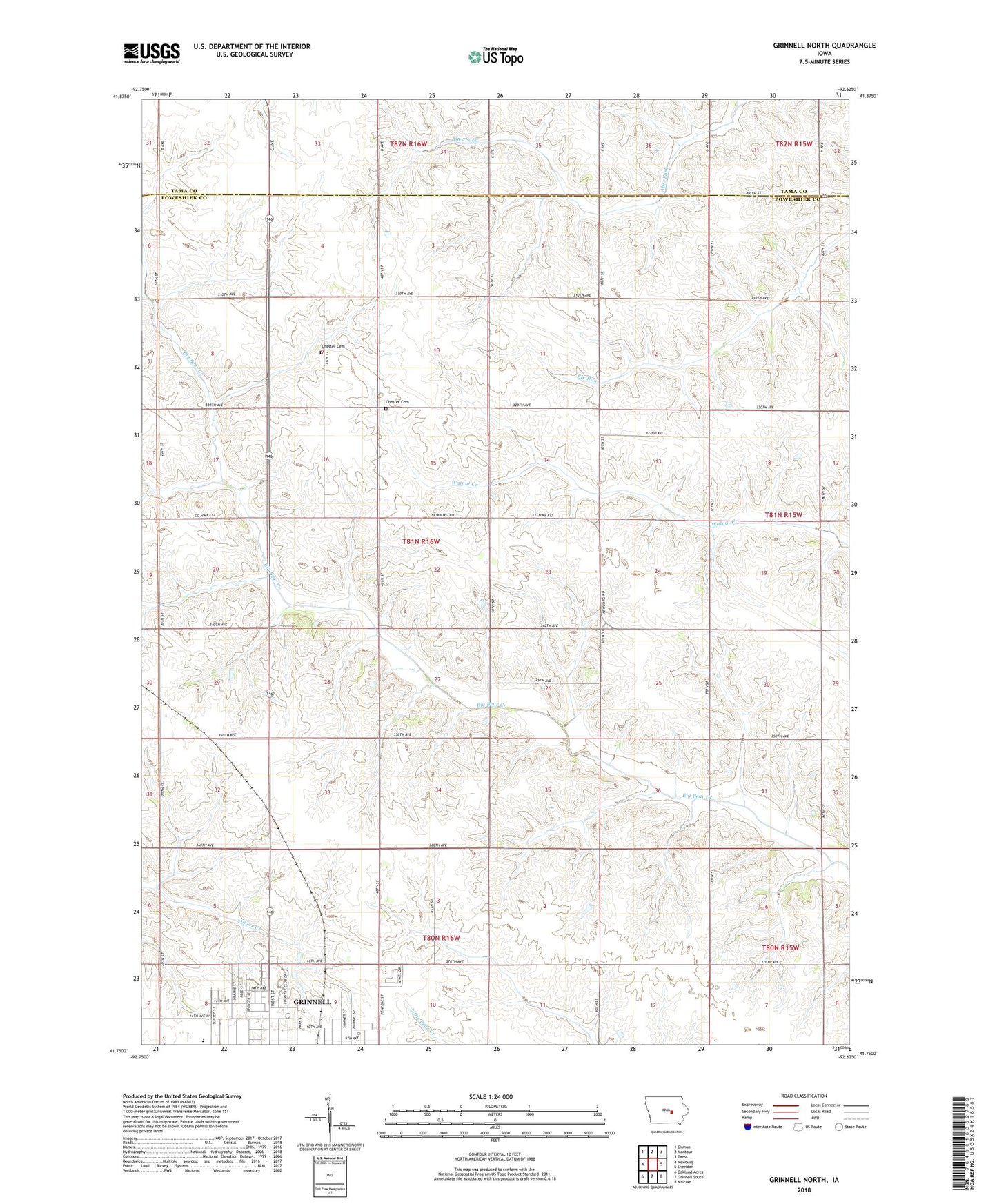
2022 topographic map quadrangle Grinnell North in the state of Iowa. Scale: 1:24000. Based on the newly updated USGS 7.5' US Topo map series, this map is in the following counties: Poweshiek, Tama. The map contains contour data, water features, and other items you are used to seeing on USGS maps, but also has updated roads and other features. This is the next generation of topographic maps. Printed on high-quality waterproof paper with UV fade-resistant inks.
Quads adjacent to this one:
West: Newburg
Northwest: Gilman
North: Montour
Northeast: Tama
East: Sheridan
Southeast: Malcom
South: Grinnell South
Southwest: Oakland Acres
This map covers the same area as the classic USGS quad with code o41092g6.
Contains the following named places: Calvary Baptist Church, Chester, Chester Cemetery, Chester Center Post Office, Chester Church, Clark Residence Hall, Conney M Kimbo Black Cultural Center, Cowles Residence Hall, Dibble Residence Hall, East Campus Residence Halls, Fairview Elementary School, Gale Observatory, Gates Residence Hall, Grinnell Community Senior High School, Grinnell Country Club, Harris Center, Immanuel Lutheran Church, Jane Springer Sports Field, KGRN-AM (Grinnell), Les Duke Track, MacEachron Field, Merrill Park, Norris Residence Hall, Paul W Ahrens / James Paschall Memorial Park, Physical Education Complex, President's House, Rawson Residence Hall, Rosenbloom Football Field, Sonora, Sonora Post Office, Township of Chester, Van-Horne Park, Ward Field