MyTopo
Gilman Iowa US Topo Map
Couldn't load pickup availability
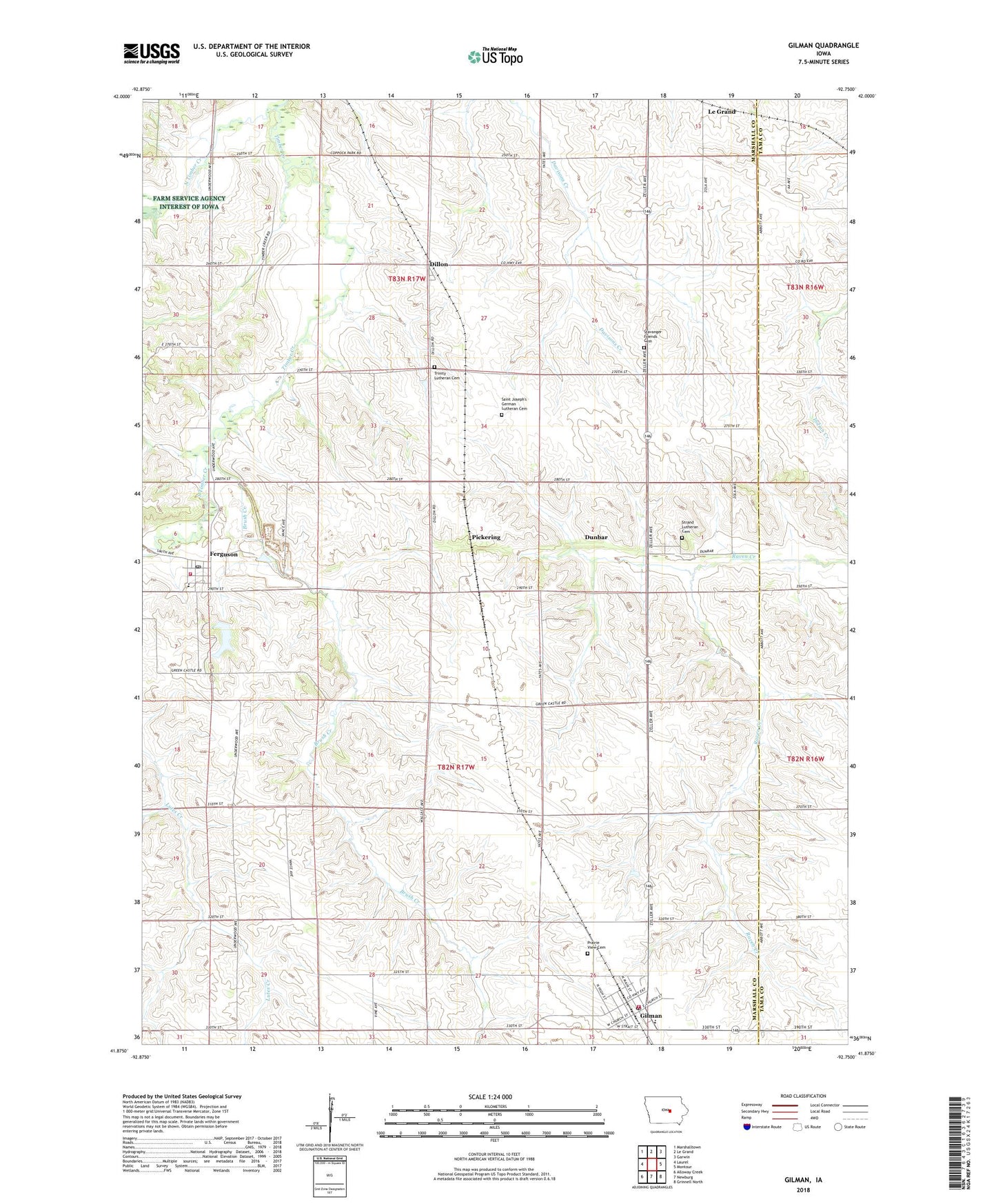
2022 topographic map quadrangle Gilman in the state of Iowa. Scale: 1:24000. Based on the newly updated USGS 7.5' US Topo map series, this map is in the following counties: Marshall, Tama. The map contains contour data, water features, and other items you are used to seeing on USGS maps, but also has updated roads and other features. This is the next generation of topographic maps. Printed on high-quality waterproof paper with UV fade-resistant inks.
Quads adjacent to this one:
West: Laurel
Northwest: Marshalltown
North: Le Grand
Northeast: Garwin
East: Montour
Southeast: Grinnell North
South: Newburg
Southwest: Alloway Creek
This map covers the same area as the classic USGS quad with code o41092h7.
Contains the following named places: Brush Creek, Christian Bible Church, City of Ferguson, City of Gilman, Dillon, Dillon Park, Dillon Post Office, Dunbar, Dunbar Post Office, East Marshall Elementary School, East Marshall Middle School, Esbeck Field, Ferguson, Ferguson Elementary School, Ferguson Fire Department, Ferguson Post Office, Ferguson Quarry, Gilman, Gilman Community Church, Gilman Fire Department, Gilman Post Office, Gilman Public Library, Gilman Town Hall, Gilman United Methodist Church, Gilman Waterworks, Green Castle Recreation Area, L D F Community School, North Timber Creek, Pickering, Pickering Post Office, Prairie View Cemetery, Saint Joseph's German Lutheran Cemetery, South Timber Creek, Stavanger Church, Stavanger Friends Cemetery, Strand Lutheran Cemetery, Strand Lutheran Church, Township of Greencastle, Township of Le Grand, Trinity Lutheran Cemetery, Trinity Lutheran Church, ZIP Codes: 50078, 50106