MyTopo
Hamburg Iowa US Topo Map
Couldn't load pickup availability
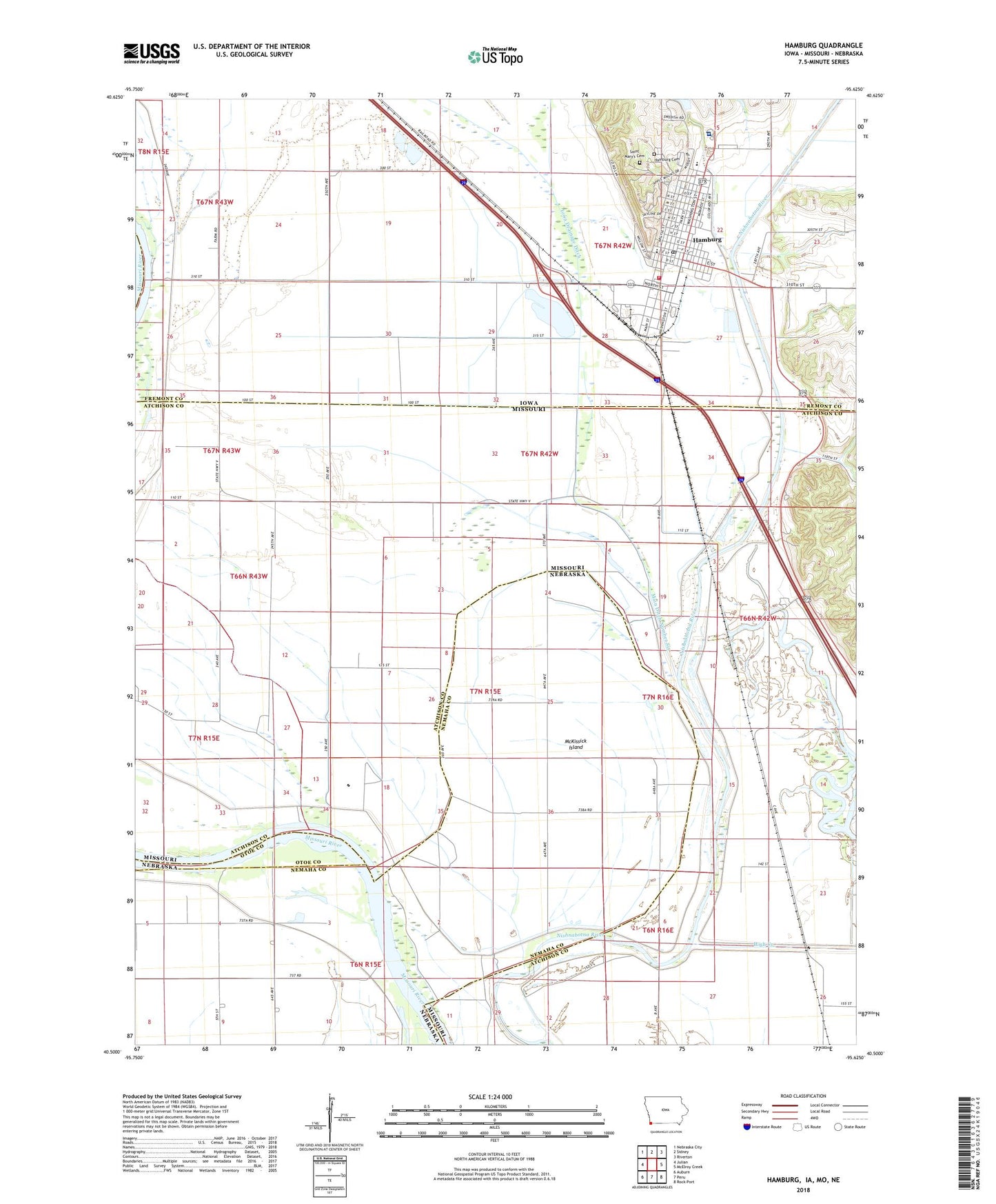
2022 topographic map quadrangle Hamburg in the states of Missouri, Iowa, Nebraska. Scale: 1:24000. Based on the newly updated USGS 7.5' US Topo map series, this map is in the following counties: Fremont, Atchison, Nemaha, Otoe. The map contains contour data, water features, and other items you are used to seeing on USGS maps, but also has updated roads and other features. This is the next generation of topographic maps. Printed on high-quality waterproof paper with UV fade-resistant inks.
Quads adjacent to this one:
West: Julian
Northwest: Nebraska City
North: Sidney
Northeast: Riverton
East: McElroy Creek
Southeast: Rock Port
South: Peru
Southwest: Auburn
Contains the following named places: Assembly of God Church, Baptist Church, Belleview School, Cargill Grain Elevator, Church of Christ, City of Hamburg, Cox Chapel, Cox Chapel School, Ellison School, First United Methodist Church, Free Methodist Church, George C Grape Community Hospital, Golden Acres Park, Grape Community Hospital Heliport, Greys Lake, Hamburg, Hamburg Airport, Hamburg Cemetery, Hamburg Chiropractic Clinic, Hamburg City Park, Hamburg Dental Center, Hamburg Middle School, Hamburg Post Office, Hamburg Public Library, Hamburg United Methodist Church, Hamburg Volunteer Fire and Rescue, Hamburg-Mitchell Access, High Creek, Iowa Drainage Ditch, Lewis School, Main Ditch Number Six, Marnie Simons Elementary School, McKissick Island, Medical Clinic, O S Wing Wildlife Management Area, Rotary Park, Saint Marys Catholic Church, Saint Marys Cemetery, Township of Buchanan, United Trinity Church, ZIP Code: 51640