MyTopo
McElroy Creek Missouri US Topo Map
Couldn't load pickup availability
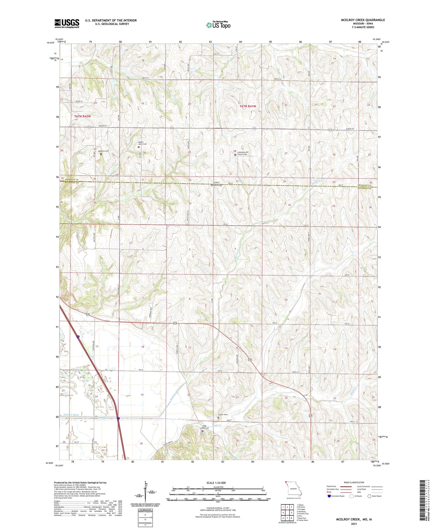
2021 topographic map quadrangle McElroy Creek in the states of Missouri, Iowa. Scale: 1:24000. Based on the newly updated USGS 7.5' US Topo map series, this map is in the following counties: Atchison, Fremont. The map contains contour data, water features, and other items you are used to seeing on USGS maps, but also has updated roads and other features. This is the next generation of topographic maps. Printed on high-quality waterproof paper with UV fade-resistant inks.
Quads adjacent to this one:
West: Hamburg
Northwest: Sidney
North: Riverton
Northeast: Farragut
East: Farmers City
Southeast: Tarkio West
South: Rock Port
Southwest: Peru
This map covers the same area as the classic USGS quad with code o40095e5.
Contains the following named places: Beehive Cemetery, Columbia and French Cemetery, High Creek Cemetery, High Creek Church, High Creek Ditch, High Creek School, Highland School, Lone Chapel, Mayflower School, McElroy Creek, McKissacks Grove, McKissacks Grove Post Office, Miller School, Mount Olive Cemetery, Mount Olive Church, Shiloh School, Star School, Stoner Cemetery, Sunny Slope School, Township of Madison, Township of Polk, Union School