MyTopo
Hanford Iowa US Topo Map
Couldn't load pickup availability
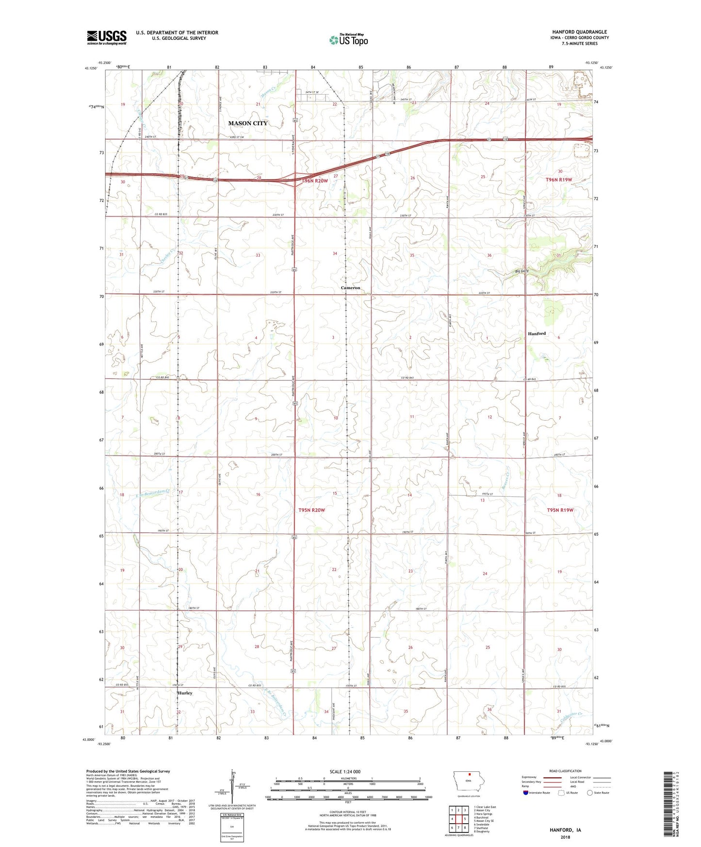
2022 topographic map quadrangle Hanford in the state of Iowa. Scale: 1:24000. Based on the newly updated USGS 7.5' US Topo map series, this map is in the following counties: Cerro Gordo. The map contains contour data, water features, and other items you are used to seeing on USGS maps, but also has updated roads and other features. This is the next generation of topographic maps. Printed on high-quality waterproof paper with UV fade-resistant inks.
Quads adjacent to this one:
West: Burchinal
Northwest: Clear Lake East
North: Mason City
Northeast: Nora Springs
East: Mason City SE
Southeast: Dougherty
South: Sheffield
Southwest: Swaledale
This map covers the same area as the classic USGS quad with code o43093a2.
Contains the following named places: Bath, Bath Post Office, Bath School Number 9, Blazing Star Prairie, Cameron, Clark Lake, Hanford, Hanford Post Office, Hurley, KCMR-FM (Mason City), Lake Fin-Feather, Lake Fin-Feather Dam, Mason City Junction, Mike Zack Wildlife Area, Portland Quarry, Township of Bath, Township of Mason