MyTopo
Hawarden North Iowa US Topo Map
Couldn't load pickup availability
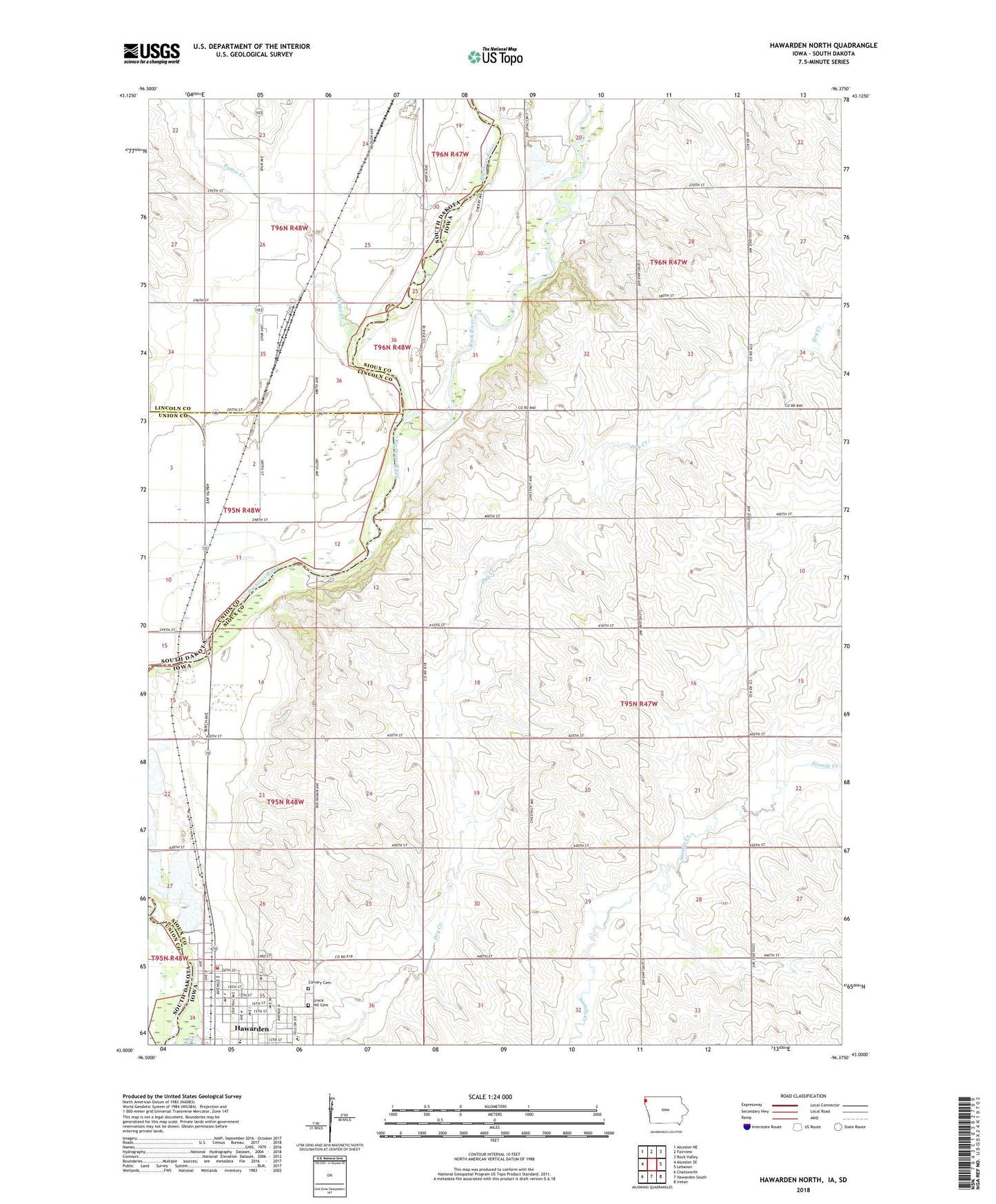
2022 topographic map quadrangle Hawarden North in the states of Iowa, South Dakota. Scale: 1:24000. Based on the newly updated USGS 7.5' US Topo map series, this map is in the following counties: Sioux, Lincoln, Union. The map contains contour data, water features, and other items you are used to seeing on USGS maps, but also has updated roads and other features. This is the next generation of topographic maps. Printed on high-quality waterproof paper with UV fade-resistant inks.
Quads adjacent to this one:
West: Alcester SE
Northwest: Alcester NE
North: Fairview
Northeast: Rock Valley
East: Lebanon
Southeast: Ireton
South: Hawarden South
Contains the following named places: Big Sioux Park, Buncombe Townhall, Calliope, Calliope Post Office, Calliope Village, Calvary Cemetery, City of Hawarden, Daale Farms, Dale Farms, Grace Hill Cemetery, Haverhals Farm, Hawarden Ambulance Association, Hawarden Community Church, Hawarden Fire Department, Hawarden Municipal Airport, Hawarden Pit, Hawarden United Methodist Church, Hillcrest Health Care Center, K and A Farms, Koenen Farms, Longview Farms, Oak Grove Park Campground, Oak Grove State Park, Pattee Creek, Rock River, Rock Sioux Access, School Number 31, Sioux Empire College, Township of Buncombe, Township of Eagle, Van Driessen Farms, West Sioux Elementary School, West Sioux Middle / High School, West Sioux Middle School, ZIP Code: 51023