MyTopo
Fairview Illinois US Topo Map
Couldn't load pickup availability
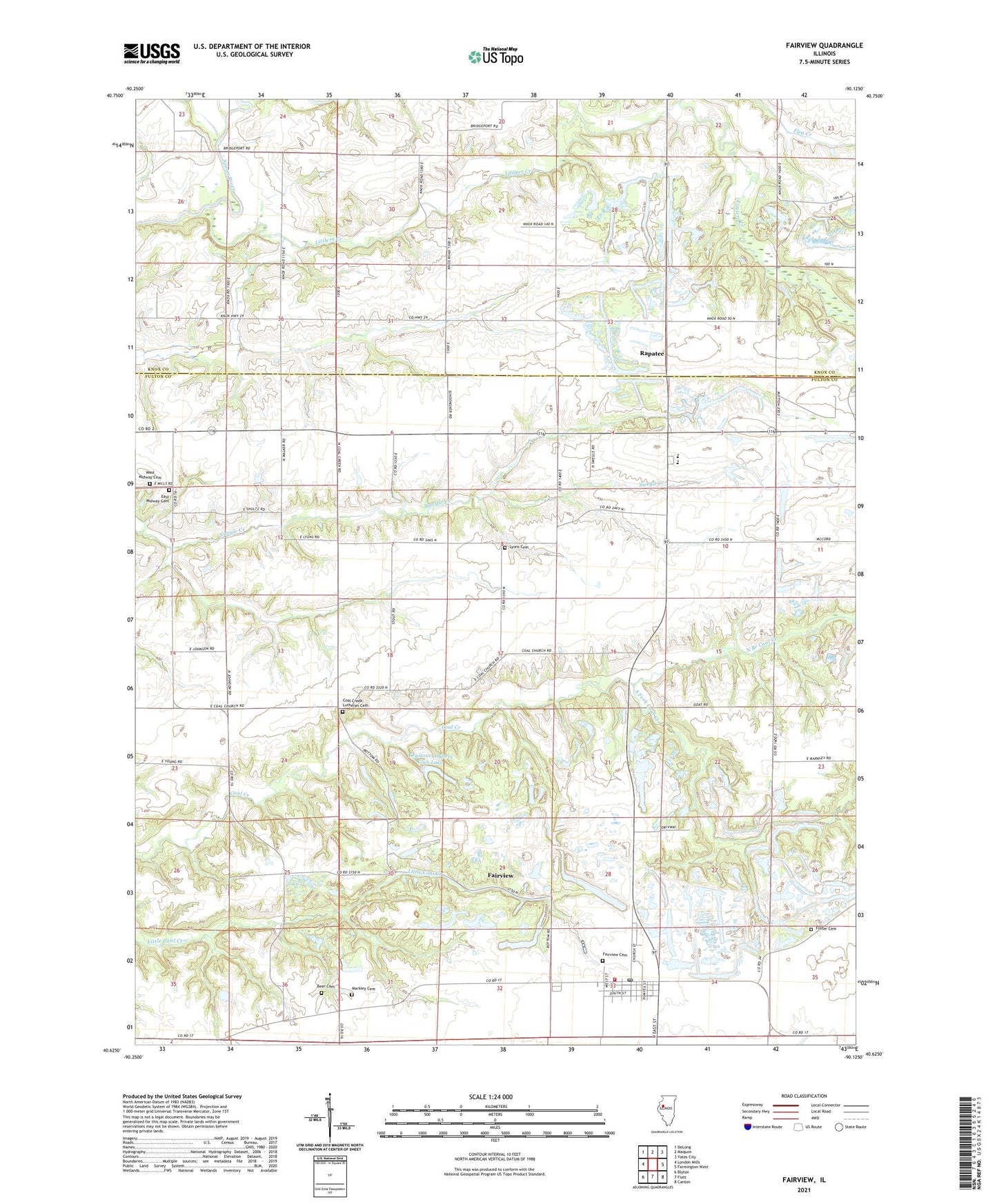
2024 topographic map quadrangle Fairview in the state of Illinois. Scale: 1:24000. Based on the newly updated USGS 7.5' US Topo map series, this map is in the following counties: Fulton, Knox. The map contains contour data, water features, and other items you are used to seeing on USGS maps, but also has updated roads and other features. This is the next generation of topographic maps. Printed on high-quality waterproof paper with UV fade-resistant inks.
Quads adjacent to this one:
West: London Mills
Northwest: DeLong
North: Maquon
Northeast: Yates City
East: Farmington West
Southeast: Canton
South: Fiatt
Southwest: Blyton
This map covers the same area as the classic USGS quad with code o40090f2.
Contains the following named places: Beer Cemetery, Bridgeport, Bridgeport Ferry, Clearfield School, Coal Creek Bible Church, Coal Creek Lutheran Cemetery, Cottonwood Corners, East Midway Cemetery, Fairview, Fairview Cemetery, Fairview Fire Protection District, Fairview Post Office, Fairview School, Flea Creek, Foster Cemetery, Hazel Dell School, Keystone Anglers Club Lake, Keystone Anglers Club Lake Dam, Littlers Creek, Lyons Cemetery, Markley Cemetery, Markley School, Middle Grove School, Midway, Midway School, North Branch Coal Creek, Oak Grove School, Old Five Lake, Old Five Lake Dam, Parville Mine, Pisgah School, Pleasant Hill School, Rapatee, Rosedale School, Schleich School, Slough Island School, South Fork Coal Creek, Speedwell School, Spoon River Valley Senior High School, Sunbeam School, Township of Fairview, Village of Fairview, West Midway Cemetery, ZIP Codes: 61432, 61544