MyTopo
Anamosa NE Iowa US Topo Map
Couldn't load pickup availability
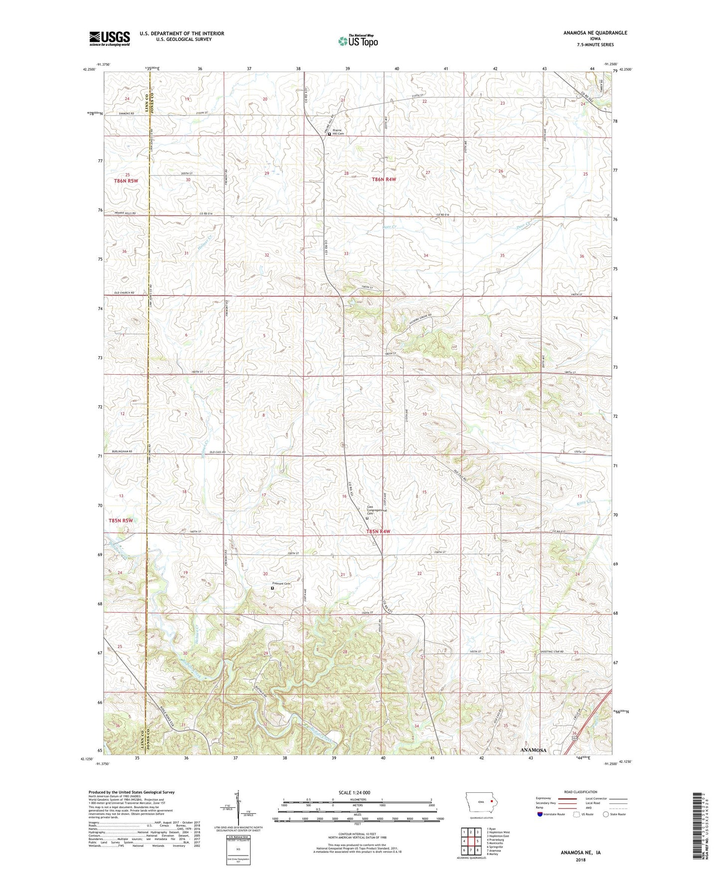
2022 topographic map quadrangle Anamosa NE in the state of Iowa. Scale: 1:24000. Based on the newly updated USGS 7.5' US Topo map series, this map is in the following counties: Jones, Linn. The map contains contour data, water features, and other items you are used to seeing on USGS maps, but also has updated roads and other features. This is the next generation of topographic maps. Printed on high-quality waterproof paper with UV fade-resistant inks.
Quads adjacent to this one:
West: Prairieburg
Northwest: Ryan
North: Hopkinton West
Northeast: Hopkinton East
East: Monticello
Southeast: Morley
South: Anamosa
Southwest: Springville
This map covers the same area as the classic USGS quad with code o42091b3.
Contains the following named places: Cass, Cass Cemetery, Cass Center Church, Cass Centre Post Office, Cass Post Office, Castle Grove Post Office, Condit Post Office, Downers Grove, Duane Post Office, Fremont Cemetery, Helmer Creek, Jackson, Prairie Hill Cemetery, Saints Peter and Paul Church, Township of Cass