MyTopo
Keystone South Iowa US Topo Map
Couldn't load pickup availability
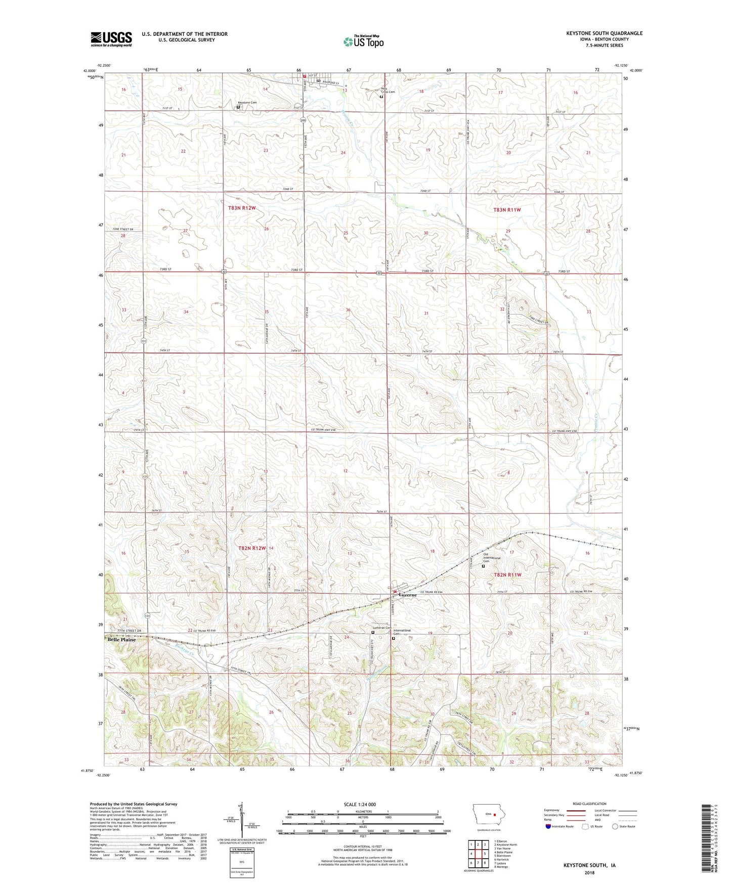
2022 topographic map quadrangle Keystone South in the state of Iowa. Scale: 1:24000. Based on the newly updated USGS 7.5' US Topo map series, this map is in the following counties: Benton. The map contains contour data, water features, and other items you are used to seeing on USGS maps, but also has updated roads and other features. This is the next generation of topographic maps. Printed on high-quality waterproof paper with UV fade-resistant inks.
Quads adjacent to this one:
West: Belle Plaine
Northwest: Elberon
North: Keystone North
Northeast: Van Horne
East: Blairstown
Southeast: Marengo
South: Ladora
Southwest: Hartwick
This map covers the same area as the classic USGS quad with code o41092h2.
Contains the following named places: Buckeye, City of Keystone, City of Luzerne, Holy Cross Cemetery, International Cemetery, Keystone, Keystone Cemetery, Keystone City Hall, Keystone Fire Department, Keystone First Responders, Keystone Post Office, Lutheran Cemetery, Luzerne, Luzerne Fire Department, Luzerne Post Office, Old International Cemetery, Pickaway Post Office, Saint Paul's Lutheran Church, Schroeder Library, Township of Iowa, Township of Kane, ZIP Code: 52257