
MyTopo
Marengo Iowa US Topo Map
Couldn't load pickup availability
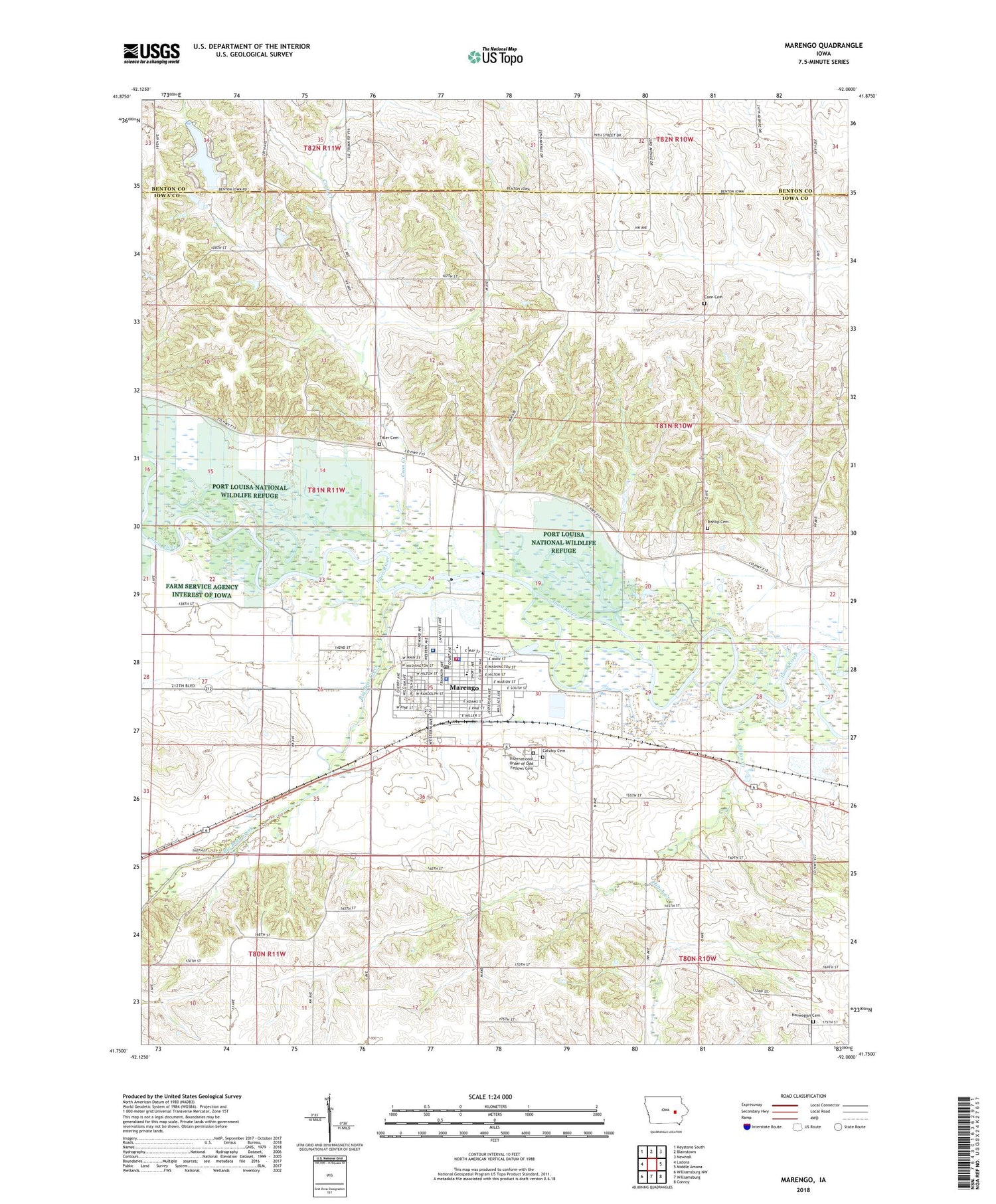
2022 topographic map quadrangle Marengo in the state of Iowa. Scale: 1:24000. Based on the newly updated USGS 7.5' US Topo map series, this map is in the following counties: Iowa, Benton. The map contains contour data, water features, and other items you are used to seeing on USGS maps, but also has updated roads and other features. This is the next generation of topographic maps. Printed on high-quality waterproof paper with UV fade-resistant inks.
Quads adjacent to this one:
West: Ladora
Northwest: Keystone South
North: Blairstown
Northeast: Newhall
East: Middle Amana
Southeast: Conroy
South: Williamsburg
Southwest: Williamsburg NW
This map covers the same area as the classic USGS quad with code o41092g1.
Contains the following named places: Big Bear Creek, Bishop Cemetery, Calvary Cemetery, Church of the Nazarene, City of Marengo, Compass Memorial Healthcare Medical Center, Conn Cemetery, Coon Creek, First Lutheran Cemetery, Hannen Lake, Hannen Lake Dam, Hannen Park, Hilton Creek, International Order of Odd Fellows Cemetery, Iowa County Ambulance Service, Iowa County Courthouse, Iowa County Fairgrounds, Iowa County Geneology Library, Iowa County Sheriff's Office, Iowa Valley Elementary School, Iowa Valley Junior - Senior High School, Kingdom Hall of Jehovahs Witnesses, Marengo, Marengo City Hall, Marengo City Lions Park, Marengo Elevator Company Elevator, Marengo Fire Department, Marengo Medical Center, Marengo Post Office, Marengo Water Treatment Plant, Memorial Park, Methodist Church, Oldest Log House in Iowa County Historical Marker, Pioneer Heritage Museum, Presbyterian Church, Rose Haven Nurse Home, Saint Johns Lutheran Church, Saint Martin Church, Saint Patricks Church, Taylors Grove, Taylor's Grove Post Office, Titler Cemetery, Township of Marengo, Township of Washington, ZIP Code: 52301


