MyTopo
Lorimor North Iowa US Topo Map
Couldn't load pickup availability
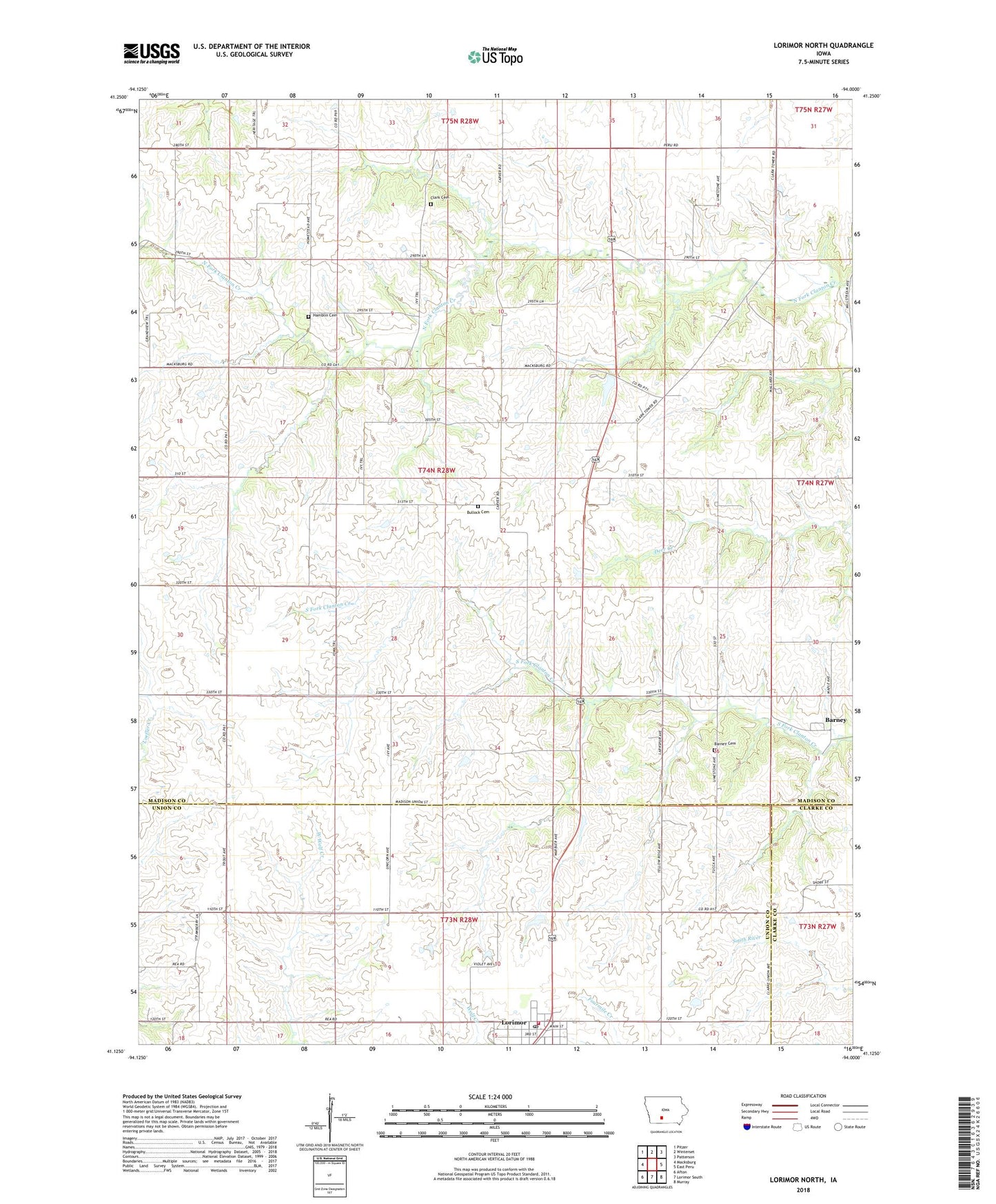
2022 topographic map quadrangle Lorimor North in the state of Iowa. Scale: 1:24000. Based on the newly updated USGS 7.5' US Topo map series, this map is in the following counties: Madison, Union, Clarke. The map contains contour data, water features, and other items you are used to seeing on USGS maps, but also has updated roads and other features. This is the next generation of topographic maps. Printed on high-quality waterproof paper with UV fade-resistant inks.
Quads adjacent to this one:
West: Macksburg
Northwest: Pitzer
North: Winterset
Northeast: Patterson
East: East Peru
Southeast: Murray
South: Lorimor South
Southwest: Afton
This map covers the same area as the classic USGS quad with code o41094b1.
Contains the following named places: Barney, Barney Cemetery, Barney Post Office, Bullock Cemetery, City of Lorimor, Clanton, Clanton Post Office, Clark Cemetery, Fellowship Church, Gear, Gear Post Office, Hamblin Cemetery, Kasson, Kasson Post Office, Lorimor, Lorimor City Hall, Lorimor City Park, Lorimor Fire Department, Lorimor First Baptist Church, Lorimor Post Office, McPherson, McPherson Post Office, Monroe Townhall, School Number 6, Township of Monroe, United Methodist Church, ZIP Code: 50149