MyTopo
Lorimor South Iowa US Topo Map
Couldn't load pickup availability
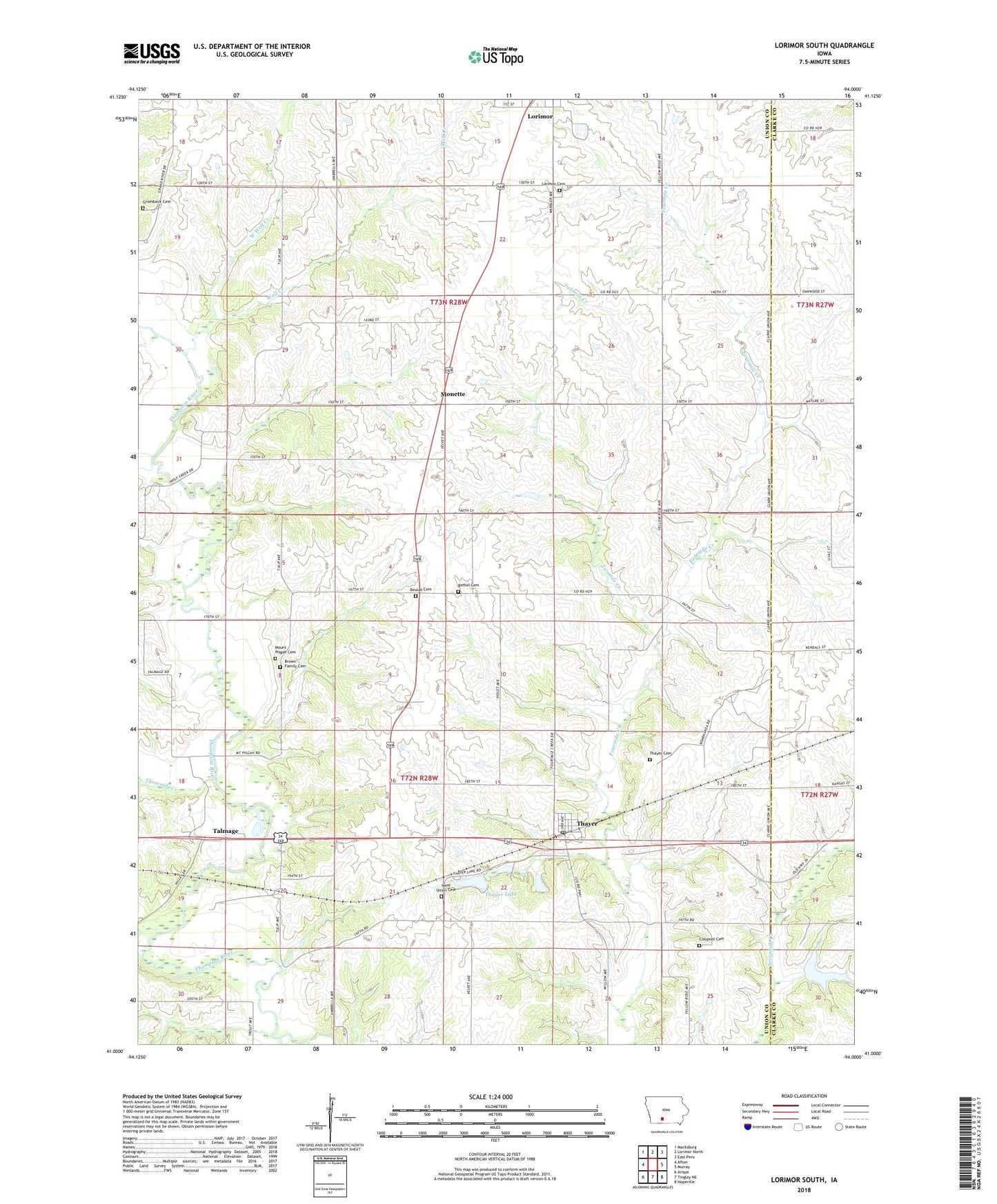
2022 topographic map quadrangle Lorimor South in the state of Iowa. Scale: 1:24000. Based on the newly updated USGS 7.5' US Topo map series, this map is in the following counties: Union, Clarke. The map contains contour data, water features, and other items you are used to seeing on USGS maps, but also has updated roads and other features. This is the next generation of topographic maps. Printed on high-quality waterproof paper with UV fade-resistant inks.
Quads adjacent to this one:
West: Afton
Northwest: Macksburg
North: Lorimor North
Northeast: East Peru
East: Murray
Southeast: Hopeville
South: Tingley NE
Southwest: Arispe
This map covers the same area as the classic USGS quad with code o41094a1.
Contains the following named places: Afton Junction, Bethel Cemetery, Beulah Cemetery, Beulah Church, Browns Mountain Cemetery, City of Thayer, Claypool Cemetery, First White Settlement in Union County Historical Marker, Groesbeck Cemetery, Kings Post Office, Lorimor Cemetery, Monette, Monette Post Office, Mount Pisgah Cemetery, Mount Pisgah Park, New Hope Post Office, Patriot Post Office, Petersville Post Office, Riverdale School, Star Branch, Talmage, Talmage Hill Park, Talmage Hill Wildlife Area, Talmage Post Office, Thayer, Thayer Cemetery, Thayer Lake, Thayer Lake Park, Thayer Ponds Public Hunting Area, Thayer Post Office, Threemile Creek, Township of Jones, Township of New Hope, Twomile Creek, West Long Creek, West Union Cemetery, West Wolf Creek, Wolf Creek