MyTopo
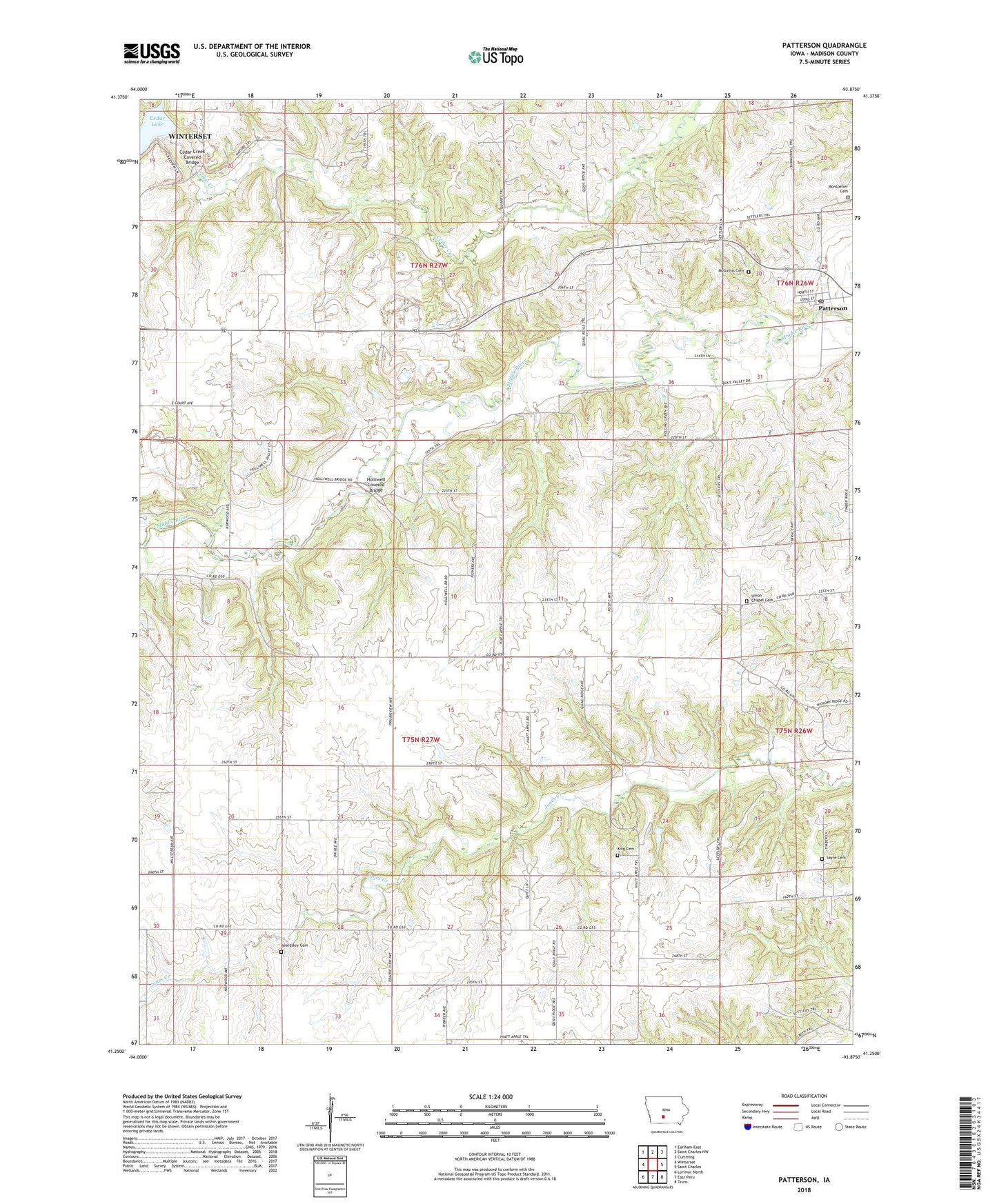
Patterson Iowa US Topo Map
Couldn't load pickup availability
2022 topographic map quadrangle Patterson in the state of Iowa. Scale: 1:24000. Based on the newly updated USGS 7.5' US Topo map series, this map is in the following counties: Madison. The map contains contour data, water features, and other items you are used to seeing on USGS maps, but also has updated roads and other features. This is the next generation of topographic maps. Printed on high-quality waterproof paper with UV fade-resistant inks.
Quads adjacent to this one:
West: Winterset
Northwest: Earlham East
North: Saint Charles NW
Northeast: Cumming
East: Saint Charles
Southeast: Truro
South: East Peru
Southwest: Lorimor North
This map covers the same area as the classic USGS quad with code o41093c8.
Contains the following named places: Amazon Post Office, Banner Post Office, Beem Cemetery, Cedar Bridge County Park, Cedar Creek Covered Bridge, City of Patterson, Elm Grove Church, Holliwell Covered Bridge, King Cemetery, Lakeview Country Club, McGinnis Cemetery, Montpelier Cemetery, Nem Con Post Office, Patterson, Patterson Post Office, Pleasant Valley Mobile Home Park, Queens Point, Queens Point Post Office, Sayre Cemetery, Scott School, Steels Branch, Tileville, Tola, Township of Scott, Township of Union, Union Chapel Cemetery, Winterset Quarry, Zion Church, ZIP Code: 50218