MyTopo
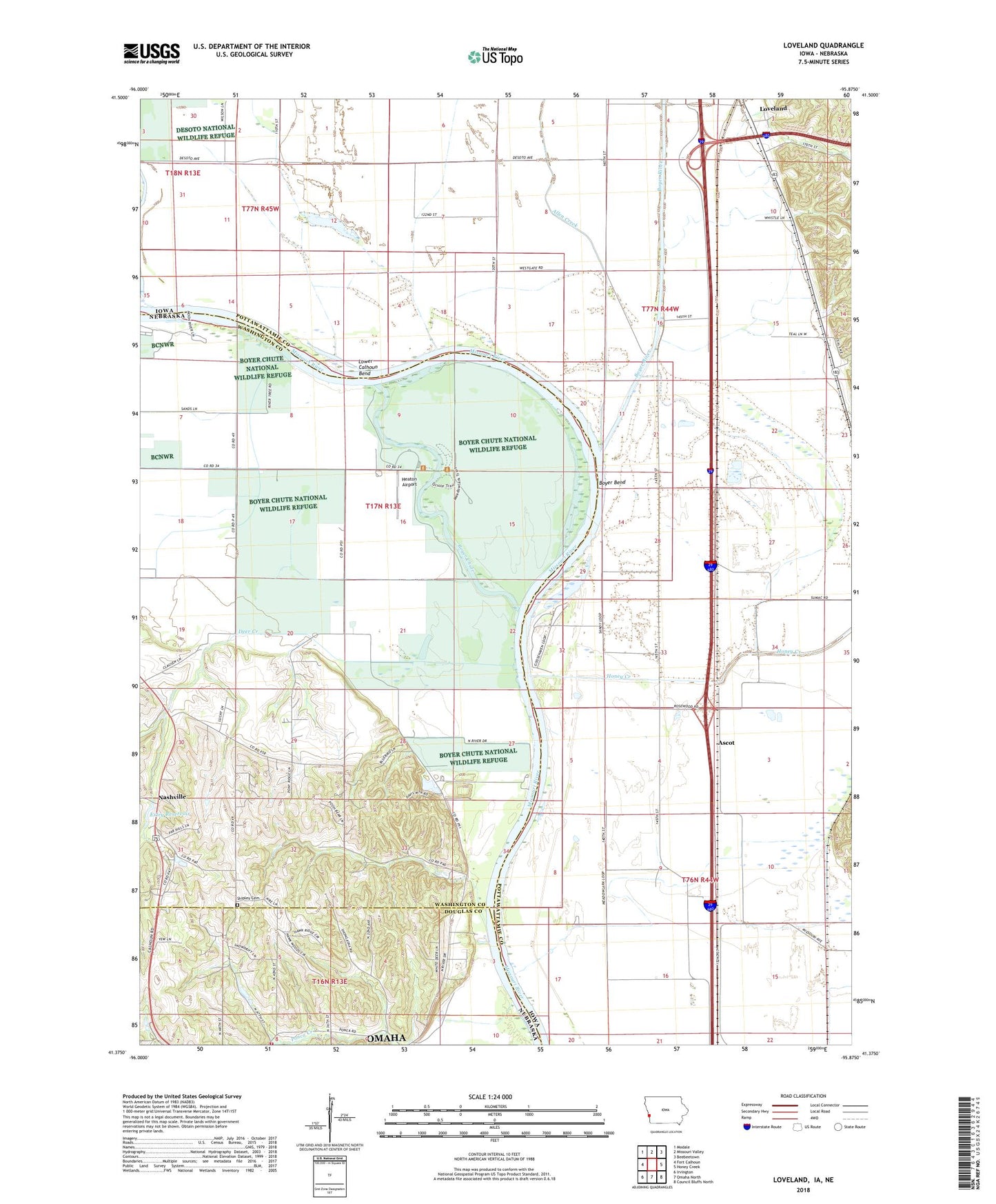
Loveland Iowa US Topo Map
Couldn't load pickup availability
2022 topographic map quadrangle Loveland in the states of Iowa, Nebraska. Scale: 1:24000. Based on the newly updated USGS 7.5' US Topo map series, this map is in the following counties: Pottawattamie, Washington, Douglas. The map contains contour data, water features, and other items you are used to seeing on USGS maps, but also has updated roads and other features. This is the next generation of topographic maps. Printed on high-quality waterproof paper with UV fade-resistant inks.
Quads adjacent to this one:
West: Fort Calhoun
Northwest: Modale
North: Missouri Valley
Northeast: Beebeetown
East: Honey Creek
Southeast: Council Bluffs North
South: Omaha North
Southwest: Irvington
Contains the following named places: Allen Creek, Ascot, Ascot Post Office, Boyer Bend, Boyer Chute, Boyer Chute National Wildlife Refuge, Boyer Chute Trails, Boyer River, Cabannes Trading Post, Deer Creek, Exley Dam, Exley Reservoir, Grable, Grable Post Office, Heaton Airport, Honey Creek, Honey Creek Campground, Honey Lake, Hummel Park, Jungbluth Dam, Jungbluth Reservoir, Loveland, Loveland Census Designated Place, Loveland Post Office, Lower Calhoun Bend, McCarthy Dam, McCarthy Reservoir, Nashville, Nashville Post Office, Neale Woods Nature Center, Ponca Elementary School, Ponca Hills Volunteer Fire Department, Shipley Cemetery, Shipley Cemetery Historical Marker, Township of Rockford, Willow, Willow Post Office