MyTopo
Manson Iowa US Topo Map
Couldn't load pickup availability
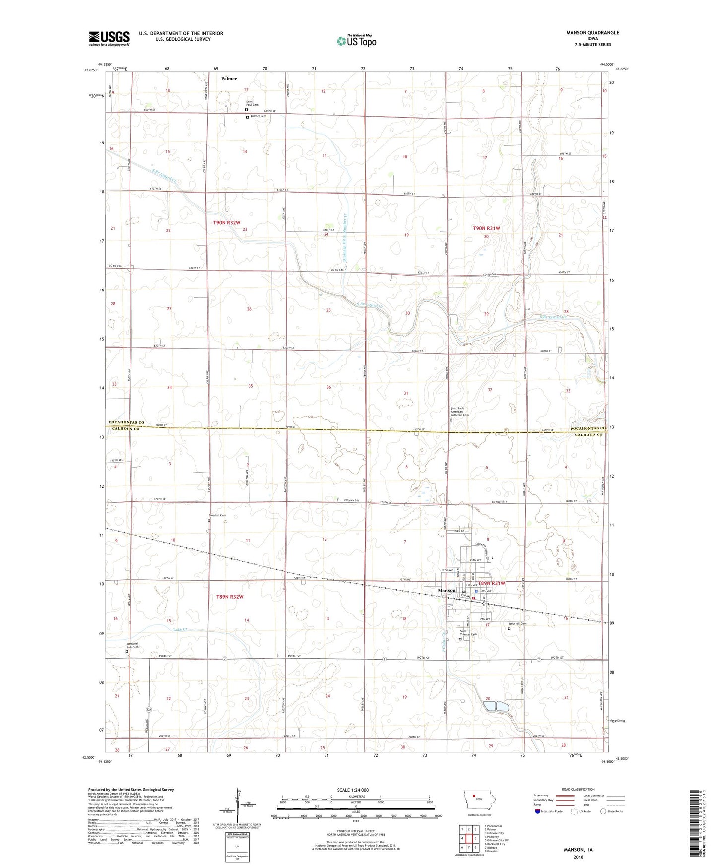
2022 topographic map quadrangle Manson in the state of Iowa. Scale: 1:24000. Based on the newly updated USGS 7.5' US Topo map series, this map is in the following counties: Pocahontas, Calhoun. The map contains contour data, water features, and other items you are used to seeing on USGS maps, but also has updated roads and other features. This is the next generation of topographic maps. Printed on high-quality waterproof paper with UV fade-resistant inks.
Quads adjacent to this one:
West: Pomeroy
Northwest: Pocahontas
North: Palmer
Northeast: Gilmore City
East: Gilmore City SW
Southeast: Knierim
South: Richard
Southwest: Rockwell City
This map covers the same area as the classic USGS quad with code o42094e5.
Contains the following named places: Augustana Evangelical Lutheran Church, Bladen, Blanden, Blanden Post Office, Buda, Calhoun County Emergency Ambulance Service, City of Manson, Drainage Ditch Number 47, Farmers Co-operative Company Elevator, Grace United Methodist Church, Kaslow Prairie State Preserve, Lincoln Number One School, Lizard Township Hall, Manson, Manson Fairground Park, Manson Fire Department, Manson Golf and Country Club, Manson Good Samaritan Center, Manson Library, Manson Mennonite Church, Manson Northwest Webster Junior / Senior High School, Manson Post Office, Manson Town Police Department, Memorial Park Cemetery, Mendenhall Park, Munson Prairie, Palmer Cemetery, Palmer Wildlife Refuge, Rose Hill Cemetery, Saint Paul Evangelical Lutheran Church, Saint Paul Lutheran Cemetery, Saint Pauls American Lutheran Cemetery, Saint Thomas Catholic Church, Saint Thomas Cemetery, Sherman School, Sinek Vision Clinic, Swedish Cemetery, Township of Bellville, Township of Lincoln, Township of Lizard, Township of Sherman, Trimark Physicians Group Center, United Church of Christ, Veterans Memorial Park, Watertower Park, Wiegert Prairie, Wiegert Prairie Farmstead, ZIP Code: 50563